Hallasan Hiking: Reach Baengnokdam via Seongpanak & Gwaneumsa
목차
- The Quick Version
- Hallasan at a Glance
- How to Get There: Hallasan Hiking Transit
- Walking the Trails: Seongpanak, Gwaneumsa, Yeongsil, Eorimok
- How to Book the Trail Reservation
- What You’ll See: From Baengnokdam to UNESCO Status
- Safety, Seasons, and What to Pack
- After the Descent: Wrapping Up with Jeju Eats
- Frequently Asked Questions
The Quick Version
- South Korea’s highest peak, Hallasan 📍 (한라산), tops out at Baengnokdam (백록담, 1,947m). You can only reach the summit via two trails — Seongpanak and Gwaneumsa — and both require a free Hallasan trail reservation for the final stretch to the top.
- Yeongsil and Eorimok are scenic routes that stop at Witseoreum, the alpine plateau — they do not connect to the Baengnokdam summit.
- Entry is free, but the entry/descent cutoff times and winter ice and wind closures are the real variables. Check the Hallasan National Park site and the weather before you set out.
If you’ve landed in Jeju, there’s one mountain you’ll keep glancing up at — Hallasan (한라산). Hallasan hiking is absolutely doable even if it’s your first trip to Korea, but if you don’t know the local rules — the trail reservation and the strict entry cutoffs — you can get turned back just steps from the summit. This one guide walks you through how to reach Baengnokdam via Seongpanak and Gwaneumsa, the transit, each trail’s flow, winter safety, and where to eat in Jeju once you’re back down.
Hallasan at a Glance
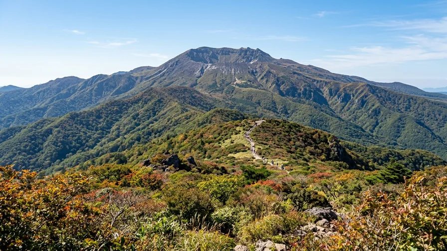
Let’s set the big picture first. Hallasan is a volcano rising in the middle of Jeju Island, and its highest point, Baengnokdam, sits at 1,947m — the tallest peak in South Korea. Entry is free, and the summit can only be reached on the Seongpanak and Gwaneumsa trails. The best seasons are October, when the foliage turns, and deep winter (December–February), when frost flowers bloom — but winter brings real risk in equal measure. Here’s the core of each trail in one table.
| Trail | Distance / Time (one way) | Difficulty / Endpoint |
|---|---|---|
| Seongpanak 📍 | 9.6km / about 4h30m | Hard / Baengnokdam summit |
| Gwaneumsa 📍 | 8.7km / about 5h | Hardest / Baengnokdam summit |
| Yeongsil 📍 | Relatively short | Moderate / up to Witseoreum |
| Eorimok 📍 | Gentle / family-friendly | Moderate / up to Witseoreum |
The reservation-required sections are above Jindallaebat on Seongpanak (cap: 1,000 people/day) and above Samgakbong on Gwaneumsa (cap: 500 people/day). Caps and operating hours can shift by season, so confirm before you go.
On-the-ground route tip
A round trip to the Seongpanak summit usually runs 9–10 hours. If you miss the Jindallaebat cutoff (around noon, roughly 12:00–12:30 depending on the season), the summit push is closed off — so an early-dawn start is basically mandatory. The key is to reach the trailhead on the first bus and get moving before the crowds pile in.
How to Get There: Hallasan Hiking Transit
The thing that trips up first-time visitors most is getting to the trailhead. Each route has its own approach, so sort it out in advance.
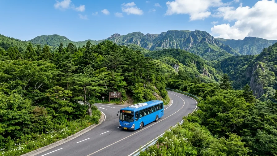
Seongpanak (the main gateway to Baengnokdam) is the easiest by public transit. From Jeju International Airport or Jeju Bus Terminal, hop on the 281 trunk bus and get off at the Seongpanak stop — it drops you right at the Seongpanak parking lot and visitor center. The 281 runs from Jeju Bus Terminal along Route 5.16 and through Seongpanak to Seogwipo Bus Terminal; because of heavy hiker demand, it has a relatively short headway for a trunk line. For exact intervals, fares, and the first departure, the Jeju Bus Information System (bus.jeju.go.kr) or a “Jeju Airport to Seongpanak” search in Naver Map will show it in real time.
The Gwaneumsa trailhead is far weaker on public transit. Getting to the 한라산국립공원 관음사탐방지원센터 📍 from Jeju City realistically means a taxi or rental car. Yeongsil and Eorimok sit toward Route 1100, so their access is different again. For the 한라산국립공원 영실 탐방로 📍 and the Eorimok trail info center, search directions per trailhead in Naver Map to confirm.
Here’s an insider tip! If you want to drive a rental car, foreign visitors need an International Driving Permit — and you can’t get one after arriving in Korea, so secure it back home before you fly out. Taxi apps like Kakao T often require a Korean phone number and a domestically issued card to sign up and pay, which makes them tricky for short-stay travelers, so keep airport taxi stands and street-hailed cabs as a backup. Bookings and phone lines run mostly in Korean, so Google Maps directions and checking for English support both come in handy.
Where to stay the night before, and a rough budget — To summit and return, you need to reach the trailhead close to the first bus, early before dawn, so staying in Jeju City or Gyorae-ri the night before is easier on logistics (both have good access to Seongpanak). For a rough budget, the 281 trunk bus is about 1,200 won and the summit certificate is 1,000 won. Gwaneumsa, Yeongsil, and Eorimok have weak public transit, so you’ll use a taxi or rental car — check the estimated taxi fare in an app like Kakao T before you set off.
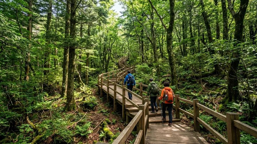
Walking the Trails: Seongpanak, Gwaneumsa, Yeongsil, Eorimok
Seongpanak Trail: The Classic Route to Baengnokdam
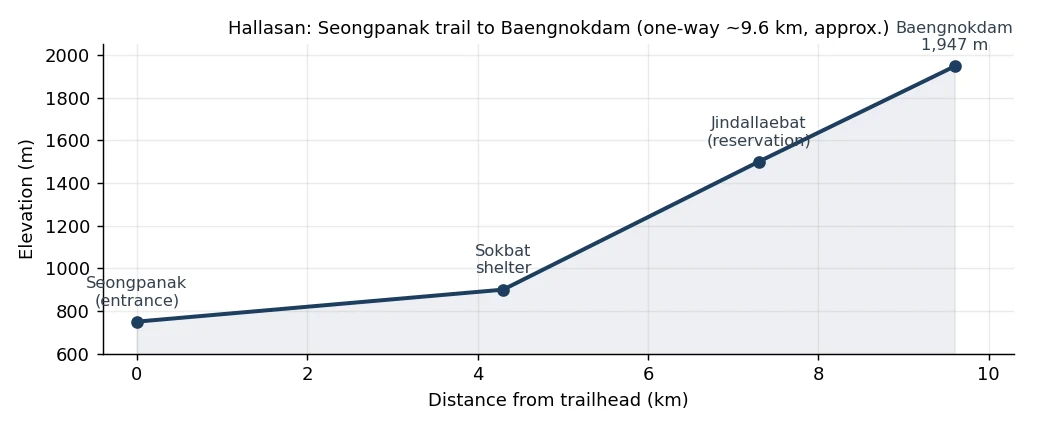
Seongpanak is a hard route — 9.6km one way, about 4 hours 30 minutes. It’s long, but the grade is relatively gentle, which is why it’s the trailhead most summit-seekers choose. From the entrance to Jindallaebat (7.3km) you can walk without a reservation, but the stretch from Jindallaebat to the Baengnokdam summit requires a trail reservation (daily cap 1,000). Entry opens at 5 a.m. (6 a.m. in winter), and the Jindallaebat cutoff is around noon (roughly 12:00–12:30 by season), so you have to clear Jindallaebat before then to reach the top. Tack on the Saraoreum overlook along the way for a bonus view of the water pooled in its crater and the surrounding ridges.
Gwaneumsa Trail: Steeper and More Dramatic
Gwaneumsa is the hardest route — 8.7km one way, about 5 hours. The steep climbs and drops are big and the terrain is rugged, so it taxes your legs and knees — but it rewards you with Hallasan’s most dramatic scenery. From the entrance to Samgakbong (6km) needs no reservation; the stretch from Samgakbong to Baengnokdam requires a trail reservation (daily cap 500). Deep valleys and rock spires unfold as you pass Tamna Valley and the Samgakbong shelter. The traverse up Seongpanak and down Gwaneumsa is the most popular for scenery, but the descent trailhead (Gwaneumsa) is weak on transit, so plan your post-hike taxi or pickup ahead of time.
Yeongsil and Eorimok: Scenic Routes to Witseoreum
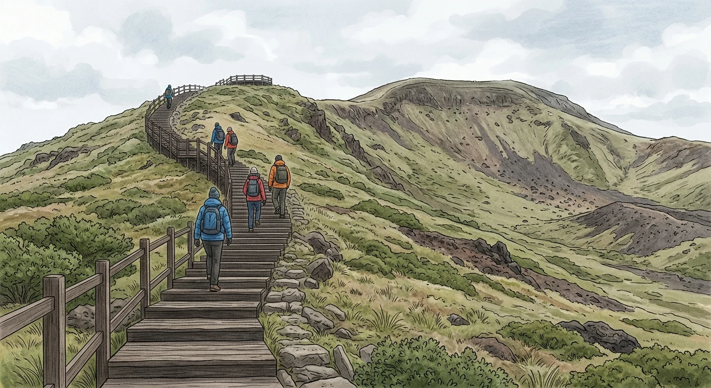
These routes don’t reach the Baengnokdam summit, but they’re widely considered the most scenic. Yeongsil has plenty of steep stone steps, yet the Byeongpungbawi (Folding Screen Rock) and Obaeknahan cliffs are stunning, and it’s relatively short to Witseoreum. Eorimok is gentle — great for families — with breezy views from Manse-dongsan. The two routes connect at the 윗세오름 대피소 📍, so you can walk a loop-style traverse, up Yeongsil and down Eorimok. Just remember: summit access to Baengnokdam is only via Seongpanak and Gwaneumsa, while Yeongsil and Eorimok stop at Witseoreum.
How to Book the Trail Reservation
The thing foreign visitors most often miss in Hallasan hiking is the trail reservation. To reach the Baengnokdam summit, you have to book — for free — through the Hallasan Reservation System (visithalla.jeju.go.kr). Applications open at 9 a.m. on the first business day of the month before your planned hike, and popular dates fill fast, so move quickly. Show the QR code you receive at the entrance.
Since May 3, 2025, the reservation requirement has been scaled back from the whole route — now you only need to book the section above Jindallaebat on Seongpanak and above Samgakbong on Gwaneumsa. In other words, if you only plan to walk up to Jindallaebat or Samgakbong and turn back, you can enter without a reservation. The caps are fixed at 1,000 for Seongpanak and 500 for Gwaneumsa, so a reservation is essential if the summit is your goal. The system and caps can change, so check the official site for the latest details before applying.
What You’ll See: From Baengnokdam to UNESCO Status
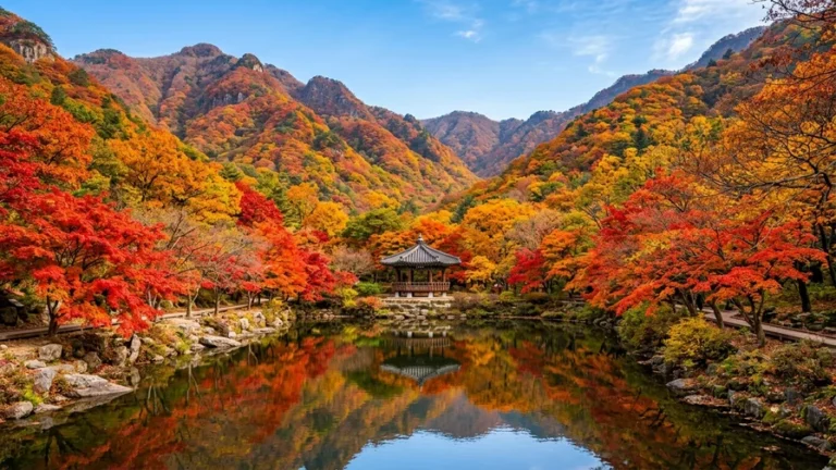
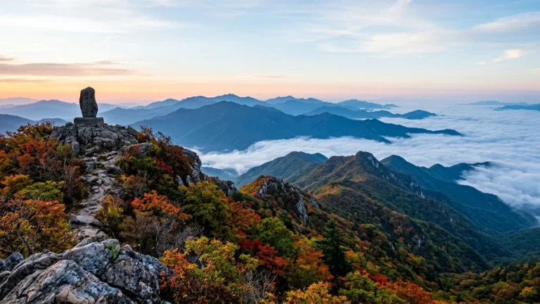
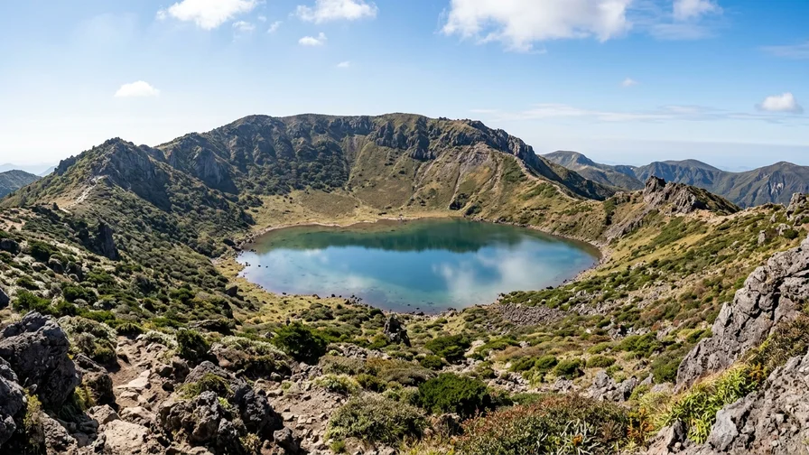
Let’s picture the views waiting at the top. Baengnokdam is the volcanic crater lake at the summit; when rain fills it, it mirrors the sky. Rockfall and no-entry warnings line the crater rim, so don’t cross the ropes and always follow the signs. In autumn, the foliage and grasslands around Jindallaebat light up, while the Witseoreum side from Yeongsil and Eorimok opens onto a broad highland plateau and Korean fir forest. Saraoreum on the Seongpanak trail is a small crater lake with pooled water — a nice gentle side trip before the summit push.
Another reason Hallasan is special: UNESCO. Jeju’s volcanic island and lava tubes, Hallasan included, are listed as a UNESCO World Natural Heritage site, a Biosphere Reserve, and a Global Geopark. With terrain shaped by volcanic activity and more than 1,800 plant species, it’s a trek that reads as geology and ecology, not just a climb.
Baengnokdam summit certificate — If you reach the top, you can pick up a Hallasan summit certificate after descending, at the Seongpanak and Gwaneumsa visitor centers, using your summit photo. It’s 1,000 won per person and cards are accepted. It makes a nice memento, so be sure to photograph the summit marker.
Safety, Seasons, and What to Pack
Hallasan is high country — over 1,500m — so the weather flips fast, and ignoring the safety rules can put you at risk. Here are the points foreign hikers especially need to nail.
- Respect the entry and descent cutoffs: Each route has set entry times, Jindallaebat and Samgakbong cutoffs, and descent deadlines. Miss them and you either can’t reach the summit or have to turn back partway.
- Handle restrooms and water in advance: There are restrooms at Seongpanak and the Jindallaebat shelter, but they’re limited along the ridge, and there’s no shop at the Baengnokdam summit. Carry at least 1 liter of water per person.
- Watch for winter ice: The deep-winter frost flowers and snowscapes are spectacular, but ice, strong wind, and snow are very dangerous. Crampons are essential, and bad weather frequently triggers full or partial entry closures.
- Check wildfire-caution periods: Korea’s national parks often close high-elevation summit trails during spring (typically March–May) and autumn (November–December) wildfire-caution periods. For hikes in these windows, check closures on the Hallasan National Park site beforehand.
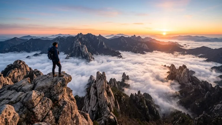
The thing to watch most differs by trail. Seongpanak is so long that pacing your stamina is the key, while Gwaneumsa has so many steep climbs and drops that it’s hard on the knees — bring trekking poles and a knee brace. Take extra care of your knees on the descent. In winter and bad weather, build the habit of checking closures on the Hallasan National Park site (Hallasan National Park official info) the night before and the morning of. Always follow the rockfall and no-entry signs at the Baengnokdam crater rim, in any season. If you’re curious about the background on Hallasan’s volcanic-island status, the Hallasan overview is a good reference.
No disposable lunchboxes, and no supplies on the ridge — To protect Hallasan, disposable lunchboxes are banned; bring low-waste food like gimbap or bread instead, and pack out all your trash. Assume there are no shops, vending machines, or water fountains on the ridge or at the summit. Don’t count on buying food or drink at the Jindallaebat shelter either, so bring at least one liter of water and snacks from the trailhead.
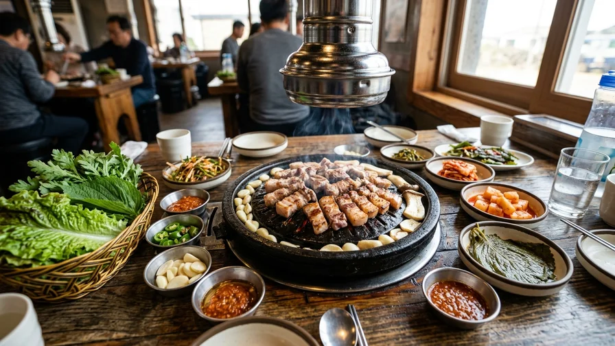
After the Descent: Wrapping Up with Jeju Eats
A warm meal is the payoff after a long hike. You’ll find hearty restaurants in Gyorae-ri near the Seongpanak trailhead and across Jeju City. Jeju’s signature dish is grilled black pork, but the “Jeju black pork” served at restaurants is usually a crossbred variety, not the pure native breed conservation-bred as a natural monument. For how to pick and grill it and the phrases to order, see our Jeju black pork guide.
- Near Seongpanak in Gyorae-ri: Gyorae Black Pork 📍 (grilled black pork, 73 Gyorae 4-gil, Jocheon-eup, Jeju City) and Seongmi Garden 📍 (a long-running spot for native-chicken dishes, Gyorae-ri)
- For a Jeju-style full table: Doldam Bapsang 📍 (Pyoseon-myeon, Seogwipo)
Older, traditional restaurants often take cash only, so carry a little cash; when there’s no English menu, use the photo menus on Google Maps or Google Translate. Hours and prices can change, so check Google Maps before you go.
Most countries ban importing meat even when it’s vacuum-sealed, so for souvenirs choose shelf-stable items like tangerine syrup or chocolate.
Frequently Asked Questions
Can you finish Hallasan hiking in one day?
Yes — Hallasan is a day-hike by default. A Seongpanak round trip usually takes 9–10 hours, and Gwaneumsa takes even longer, so an early start matters. There are no overnight lodging shelters near the summit, so night hiking and bivouacking aren’t allowed.
Can you go without a reservation?
You can enter without a reservation as far as Jindallaebat (Seongpanak) or Samgakbong (Gwaneumsa). But to reach the Baengnokdam summit, a reservation for the section above is required. The Yeongsil and Eorimok routes (up to Witseoreum) don’t reach the summit, so they aren’t subject to the summit reservation.
Can you climb to Baengnokdam in winter?
You can, but ice, strong wind, and snow sharply raise the risk. Crampons are essential, and entry is often closed on bad-weather days, so be sure to check closures on the Hallasan National Park site the night before and the morning of.
Can foreign visitors make a trail reservation?
Yes — you can apply for free through the Hallasan Reservation System. Reservations open at 9 a.m. on the first business day of the month before your hike, and you show the QR code you receive at the entrance. Popular dates fill quickly, so book early once your plans are set.
Hallasan is a mountain you can tackle solo as a foreign visitor, as long as you sort out your trail choice, the reservation, and the cutoff times in advance. Before you go, lock in your summit reservation on the Hallasan Reservation System, check the day’s weather and closures, then reach the trailhead on the first bus. If you’re curious about the bigger picture of trekking Korea’s famous peaks, get the full flow in our intro guide to Korean mountain trekking. Fold the map away for now, follow this route, and take Baengnokdam one step at a time.
Related reads in this series
- Hiking in Korea: A Guide to 5 Incredible Peaks from Bukhansan to Hallasan
- Bukhansan Hiking by Subway: 3 Routes to Baegundae (836m)
- Seoraksan Hiking from Sokcho: Ulsanbawi & Daecheongbong
- National Park Trekking in Korea: 4 Iconic Ridge & Crater Routes
- Hiking in Korea by Public Transport: A Car-Free Guide
- Post-Hike Recovery in Korea: Hot Springs, Saunas & Food
- Jirisan Hiking: Nogodan to Cheonwangbong, Routes & Access
- Naejangsan Autumn Hiking: Seoraebong & Sinseonbong by Train