Jirisan Hiking — Trails and Access from Nogodan to Cheonwangbong
목차
- How Does the Jirisan Overview Break Down at a Glance?
- How Do You Get to Jirisan from Seoul?
- Where Do You Start the Jirisan Courses and How Do You Walk Them?
- What Will You See on Jirisan?
- Safety and Seasons: What Should You Prepare?
- After the Hike, Where Do You Rest and What Do You Eat?
- Jirisan Hiking: Frequently Asked Questions
Quick Summary
- For Jirisan 📍, the trailheads are scattered across Gurye, Sancheong, Hamyang, and Hadong, so the trick is to plan your transport backward, starting from the peak you want to reach.
- The easiest high peak is Nogodan 📍 (1,507m), climbed from Seongsamjae 📍, while the highest summit is Cheonwangbong 📍 (1,915m), climbed from Jungsan-ri. The traverse linking the two usually takes two days with one overnight, so a shelter reservation is essential.
- It helps to book the Nogodan summit trail reservation and your shelter stay in advance. The Jangteomok shelter in particular switches from first-come, first-served to a lottery system starting in 2026, so it is important to enter during the application window ahead of time.
Among Korea’s famous mountains, Jirisan hiking stands out for its scale and complex layout, which is exactly why first-time visitors agonize over it the most. This single article walks you through how to reach Nogodan, Cheonwangbong, and the full traverse, step by step, so read it slowly with a map app open.
How Does the Jirisan Overview Break Down at a Glance?
The bottom line is that Jirisan hiking falls into place once you settle just two questions: which peak, and whether you go as a day trip or stay overnight. Jirisan is a large mountain spanning Hamyang County in South Gyeongsang Province along with Gurye, Sancheong, and Hadong, and its highest point, Cheonwangbong Peak, rises 1,915m, making it the second-highest peak in South Korea.
The table below compares the distance, time, and difficulty of three representative courses. Admission fees (such as cultural heritage viewing fees) have been abolished, so there is no separate charge, but parking and shelter fees apply.
| Course | Distance, Time | Difficulty |
|---|---|---|
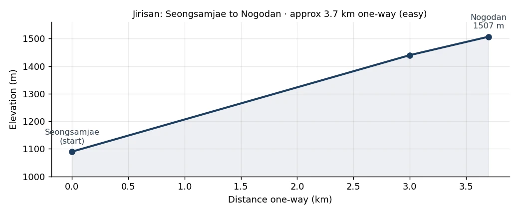
| Nogodan (from Seongsamjae) | about 3.7km one way, 1–1.5 hours | Beginner |
| Cheonwangbong (from Jungsan-ri) | about 7.5km one way, 5 hours 30 min | Advanced |
| Traverse (Seongsamjae→Cheonwangbong) | about 25–33km, 2 days 1 night | Expert |
🧭 Which Course Should You Pick?
If it is your first time or your fitness feels uncertain, the round trip from Seongsamjae to Nogodan is the best option. In just over an hour, you can stand on a 1,507m peak with sea-of-clouds views and ridgeline scenery. Note that the Nogodan summit area runs on a trail reservation system, so you need to apply in advance through the Korea National Park Service reservation site. Cheonwangbong (1,915m) and the traverse are no small undertaking in distance and elevation, so allow plenty of fitness and time, and if you plan to traverse, secure your shelter reservation first.
There are two kinds of reservations. The Nogodan summit area uses a trail reservation system through the Korea National Park Service site, while the shelters used for the traverse require a separate overnight booking. Shelter overnight fees are per person per night, and rates that had been frozen for a long time rose in 2026. Since these numbers change often, like bus fares, we will not hard-code them here. When you book, check the exact current rate on the Korea National Park Service reservation system (reservation.knps.or.kr).
Shelter fees (raised January 2026): per person per night, 20,000 won on weekdays and 30,000 won on weekends and peak season (Korea National Park Service facility fee). From usage dates of July 1, 2025, 13 national park shelters nationwide switched to a year-round lottery system, accepting applications for two-month blocks over 5–7 days starting on the 1st of even-numbered months. You can check the application schedule and lottery results at reservation.knps.or.kr.
The best seasons are autumn, when seas of clouds meet the fall foliage, and early summer, when the fresh greenery is deep.
🌐 Where Foreigners Get Stuck Most: Reservation ID Verification
The Korea National Park Service reservation system often requires identity verification using a Korean mobile number, which is where foreign travelers most commonly get stuck. If you do not have a Korean number, the practical options are to (1) verify your identity using the Korean number on a local SIM or eSIM, or (2) make the reservation under the name of a Korean companion traveling with you. English guidance is limited, so turning on your browser’s translation feature makes the reservation screens much easier to handle. Both the trail reservation and the shelter lottery entry use the same system.
Pre-Hike Checklist
Confirm just three things before you set off. First, if you are going to Nogodan, did you make a trail reservation through the Korea National Park Service site? Second, if you are doing the traverse, did you book shelters such as Nogodan, Seseok, or Jangteomok? Third, is Nogodan-ro, the road up to Seongsamjae, not under a closure period? Sort out these three in advance and you won’t have to turn back on the spot.
How Do You Get to Jirisan from Seoul?
Traveling by your own car or a rental gives you far more flexibility in planning. To drive in Korea as a foreign traveler, you must carry your International Driving Permit (IDP), your home-country license, and your passport all together. The IDP cannot be issued once you have already entered Korea, so be sure to prepare it before departure.
The key point is that getting to the Nogodan side and the Cheonwangbong side involves completely different transport. Because Jirisan’s trailheads are scattered all around, the buses you take differ by course even though it is the same mountain.
Getting to the Nogodan Side
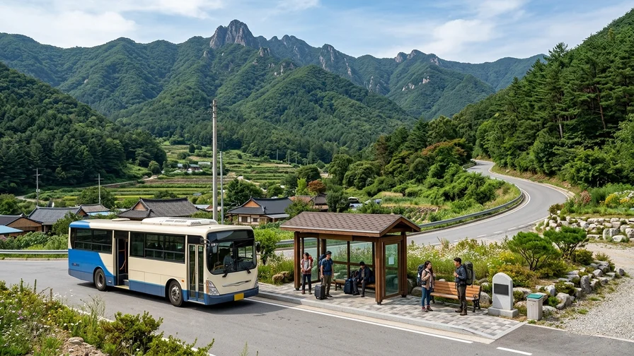
If Nogodan is your goal, head to Gurye first. Travel from Seoul to Gurye by bus or train, then take a bus bound for Seongsamjae Service Area from Gurye Public Bus Terminal and get off at Seongsamjae. The short climb from Seongsamjae to Nogodan makes it very popular. However, during periods when Nogodan-ro up to Seongsamjae is closed, the Seongsamjae buses stop running, so be sure to check service before you leave. People sometimes miss the closure notice and end up stranded in Gurye.
Getting to the Cheonwangbong Side
If Cheonwangbong is your goal, the standard route is to take an intercity bus from Seoul Nambu Terminal. Take a bus bound for Baekmudong (a trailhead on the Hamyang side at the northern foot of Jirisan; Hamyang Jirisan Express, about twice a day) or for Jungsan-ri. Once you reach Jungsan-ri, you can take a village bus into Sundyu (a spot deeper inside Jungsan-ri, closer to the Cheonwangbong trailhead), which shortens the walking distance to Cheonwangbong and eases the strain on your legs considerably.
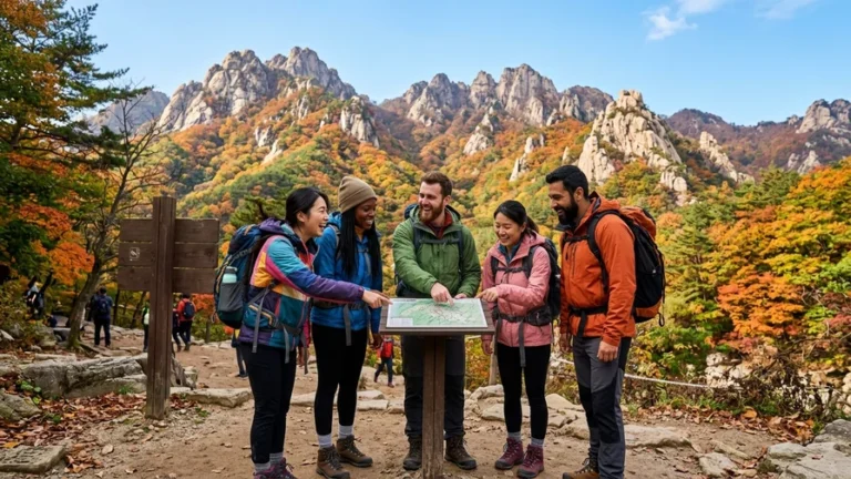
Bus times and fares change by season, so rather than relying on made-up numbers, we recommend searching directly in the Bustago app or Naver Map. Search “Seoul to Gurye,” “Seoul Nambu to Baekmudong,” or “Seoul Nambu to Jungsan-ri” to get accurate departure times and fares. For reference, it takes roughly 3 hours 30 minutes to 4 hours by bus from Seoul to Gurye or Hamyang. For a day hike, you need to leave early in the morning, close to the first bus, to have enough time to reach the summit and return. Skimming the Jirisan geographic info (Wikipedia) in advance helps you picture where the trailheads are.
🔁 You May Not Descend the Way You Came Up
On Jirisan, the trailhead where you start and where you descend are often different. For example, if you climb Cheonwangbong from Jungsan-ri and descend to Baekmudong, you end up on the opposite side of the mountain, so the return transport is completely different from how you arrived. It may not be a loop back to your starting point, so check in advance the buses from your descent point to your next destination or accommodation.
The Night Before and a Rough Budget — Since it takes about 3 hours 30 minutes to 4 hours by bus from Seoul to Gurye or Hamyang, for a same-day summit hike it is safer to stay overnight in Gurye or Jungsan-ri and reach the trailhead on the first bus. There is one direct intercity bus per day from Dong Seoul to Seongsamjae (Nogodan); otherwise you transfer via Gurye to a Seongsamjae bus. Check intercity bus fares in the Bustago app or at the terminal before departure (and shelter overnight fees on the national park reservation system).
Where Do You Start the Jirisan Courses and How Do You Walk Them?
Jirisan hiking courses divide broadly into the Nogodan day trip, the Cheonwangbong day trip, and the traverse linking the two. Just pick one that matches your fitness and schedule.
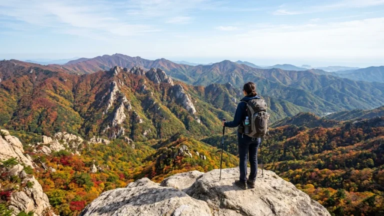
Nogodan: The Easiest 1,500m-Class Peak to Climb
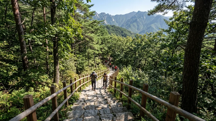
Nogodan stands at 1,507m, yet starting from Seongsamjae it is a beginner course of about 3.7km one way to Nogodan Pass, reachable in 1 to 1.5 hours. The trail is well maintained, making it perfect for trekking beginners. Note, though, that the Nogodan summit area runs on a trail reservation system, so you can only go up if you apply in advance through the Korea National Park Service site. Some people who go without a booking only see the pass and turn back, so if you want to stand on the summit, be sure to secure a reservation. It is also famous as a spot for seas of clouds and sunrises.
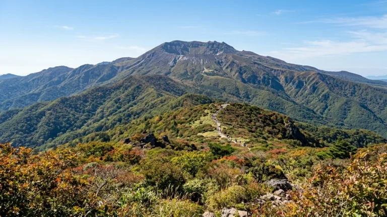
Cheonwangbong: A Summit of Long, Steep Stone Steps
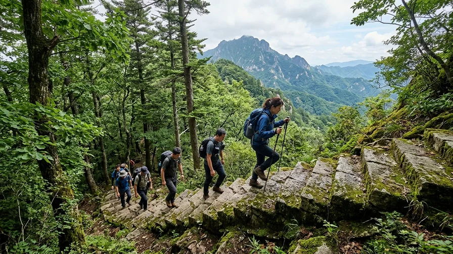
Cheonwangbong is an advanced course of about 7.5km one way, taking 5 hours 30 minutes from Jungsan-ri via Beopgyesa and Jangteomok to the summit. A day trip is possible, but the long, steep stone steps make fitness essential. Because the strain on your knees is significant, packing hiking poles and a knee brace in advance makes the descent far easier. Many people set out before dawn to catch the sunrise, in which case a headlamp and warm gear are absolutely necessary.
🧤 Cheonwangbong Stone Steps: Poles and a Knee Brace
The Jungsan-ri and Baekmudong courses up Cheonwangbong center on endless steep stone steps, which put heavy strain on the knees. Bring hiking poles and a knee brace, and descend slowly, since knee injuries are common on the way down. Keep your hands free by using a pole in each hand.
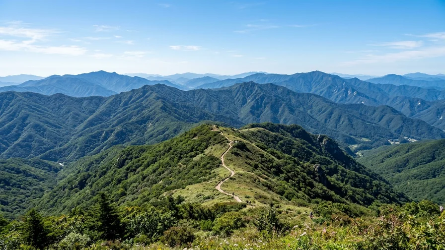
Jirisan Traverse: From Nogodan to Cheonwangbong
The traverse follows the ridgeline from Seongsamjae past Nogodan all the way to Cheonwangbong, and at about 25 to 33km it is usually done over two days with one overnight. Reservations for shelters such as Nogodan, Seseok, and Jangteomok are essential, and without one the traverse itself is impossible. Jangteomok shelter in particular is highly competitive, popular for the sunrise hike to Cheonwangbong. From 2026, shelters run on a lottery rather than first-come, first-served, so you generally apply during the application window (usually 1–2 months before your stay) and wait for the lottery results.
What Will You See on Jirisan?
The appeal of Jirisan hiking goes beyond simply tagging the summit. The scenery lingers, from the ancient temples at the foot of the mountain to the seas of clouds on the ridgelines and the sunrise from the summit.
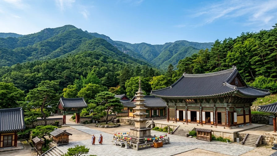
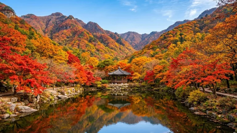
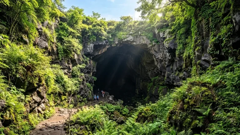
From the Gurye trailhead, you can stop by the thousand-year-old temple Hwaeomsa 📍. Located at 539 Hwaeomsa-ro, Masan-myeon, Gurye-gun, South Jeolla Province, it is well known for its majestic Gakhwangjeon hall and stone pagodas, making it a fine place to visit before or after your hike. Within the temple grounds, it is courteous to refrain from loud talking and from taking photos inside the prayer hall.
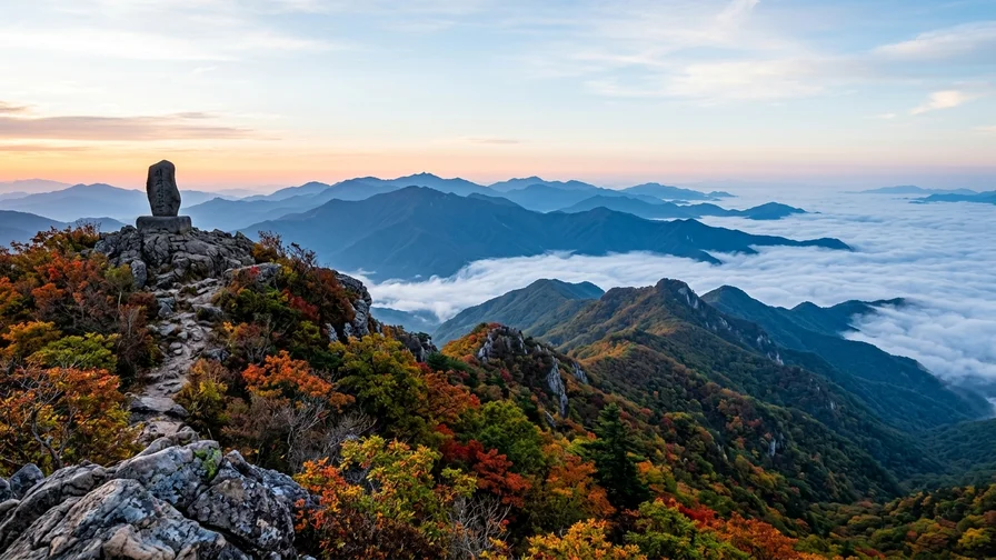
Once you reach the ridge, the Nogodan sea of clouds spreads out over the valleys at dawn. The phenomenon appears only when the weather and humidity align, so you cannot always count on it, but it is an unforgettable sight if you do catch it. And the sunrise from the Cheonwangbong summit marker is considered the highlight of Jirisan hiking. That said, the summit is fiercely windy and the temperature plunges, so if you are aiming for the sunrise, pay particular attention to staying warm.
Safety and Seasons: What Should You Prepare?
Jirisan rises above 1,500m, so its weather is completely different from the lowlands. Knowing the seasonal hazards and gear in advance is the start of a safe hike.
In winter, ice, strong winds, and snow are very dangerous, so crampons are essential, and section closures are frequent when there is heavy snow. During the spring and autumn fire-prevention periods, high-altitude trails are closed, so be sure to check the closed sections before you set off. Closure notices are available on the Korea National Park Service reservation system and official announcements.
Don’t let your guard down just because it is summer. At 1,915m, the Cheonwangbong summit gets chilly when the wind blows even in midsummer, and lingering there in sweat-soaked clothes can drop your body temperature fast. Pack a thin windbreaker no matter the season. In summer, the risk of showers, thunder, and lightning grows as the afternoon wears on, so aim to finish your route on the ridge by early afternoon, and if thunder strikes, get off the ridge and summit and down to lower ground.
Restrooms are at the Seongsamjae rest area and the shelters, but not along the ridge. So it is best to go in advance at the trailhead, and bring at least 1 liter of water per person. The Jungsan-ri and Baekmudong courses up Cheonwangbong are long, steep stone steps that strain the knees, so hiking poles and a knee brace are less optional than near-essential.
Don’t Count on Resupply on the Ridge — The shops and sales at Jirisan’s shelters (Jangteomok, Seseok, Nogodan, and others) are shrinking or disappearing for the sake of the environment (cup noodles and similar items are no longer sold). Whether traversing or on a day hike, prepare enough water and food at the trailhead, and pack out all your trash.
After the Hike, Where Do You Rest and What Do You Eat?
Mountain-vegetable set meals (sanchae jeongsik) are vegetable-centered, but some side dishes contain jeotgal (fermented seafood liquid), and the doenjang stew broth may use meat or seafood. If you are a strict vegetarian, ask the restaurant before ordering, “Can this be made without meat or seafood?”
The way to wrap up a Jirisan hike is with the food in the trailhead villages. The Gurye Hwaeomsa side is famous for mountain-vegetable set meals, and the Hadong side along the Seomjin River is known for clam dishes, so choose according to your descent route.
- Jirisan Restaurant 📍 (Gurye Hwaeomsa) is known for a mountain-vegetable set meal with more than 20 kinds of wild greens harvested on Jirisan filling the table, hearty alongside a savory doenjang stew.
- Yewon 📍 (Gurye) is a designated “Century Store,” where the mountain-vegetable and deodeok (mountain bonnet bellflower root) set meals are clean and refined, served like a Korean fine-dining spread.
- Geu-yetnal Sanchae Restaurant 📍 (Gurye Hwaeomsa) is a long-standing eatery on the road to Hwaeomsa, with a generous mountain-vegetable spread paired with wild greens and grilled deodeok.
- Sannamul Bapsang 📍 (Gurye) is popular for its seasonal wild-greens set meal and pajeon (green-onion pancake), a good fit when you want a light meal.
- Wonjo Gangbyeon Halmae Jaecheop Restaurant 📍 (Hadong, Seomjin River) is known for a refreshing clam soup made with Seomjin River clams and a tangy clam-with-vegetables salad, well worth a stop if you descend on the Hadong side.
Jirisan Hiking: Frequently Asked Questions
Does Nogodan really require a reservation?
Yes, the Nogodan summit area runs on a trail reservation system, so you must apply in advance through the Korea National Park Service site. You can walk from Seongsamjae to Nogodan Pass without a reservation, but entry to the summit area requires one.
Is a Cheonwangbong day trip really possible?
It is possible, but you need the fitness for it. From Jungsan-ri it is an advanced course of about 7.5km one way over 5 hours 30 minutes, so a round trip takes a full day. We recommend leaving before dawn and bringing hiking poles and a knee brace.
When should you reserve a shelter?
Popular shelters like Jangteomok are fiercely competitive. From 2026, shelters and campsites run on a lottery rather than first-come, first-served, so if you are planning a traverse or sunrise hike, mark the application window (usually 1–2 months before your stay) on your calendar, enter, and then check the lottery results. The Korea National Park Service reservation system provides the exact schedule and method.
Is Jirisan hiking possible in winter?
It is possible, but the difficulty rises sharply. Ice, strong winds, and snow make crampons essential, and section closures are frequent. If you have little winter hiking experience, don’t push it, and check closure information first.
If you have followed along this far, you should have the big picture of Jirisan hiking, from Nogodan to Cheonwangbong and the traverse. Before you set off, check the bus times for your chosen course in a map app in advance, and don’t forget the Nogodan trail reservation and your shelter booking. Follow this and you won’t be wandering lost from your first day on arrival. If you want a fuller picture of trekking Korea’s famous mountains, take a look at the introduction to Korea mountain trekking, and browse more information at Come On Korea as well.
Related reads in this series
- Hiking Mountains in Korea, How to Pick Your First Peak
- Bukhansan by Subway from Seoul — Baegundae Route and How to Get There
- Seoraksan from Sokcho — Cable Car to Daecheongbong Peak
- National Park Trekking in Korea, Reservations, Closures and Shelters
- Reach Korean Mountains by Public Transport, No Car Needed
- Hot Springs After Hiking — Recovery Spots Near Korea's Peaks
- Hallasan Hiking to Baengnokdam via Seongpanak and Gwaneumsa
- Naejangsan Autumn Hiking by Train, Seoraebong and Sinseonbong
- Sobaeksan Hiking — Shortest Route to Birobong Peak and the Azalea Ridge
- Baekdudaegan Mountain Range, Korea's Spine and One Hike