Hiking Mountains in Korea, How to Pick Your First Peak
목차
- Quick Takeaways
- Why Hiking Mountains in Korea Is Having a Moment
- Picking a Mountain by Your Goal
- Beginner Mountains in Korea, Sorted by Difficulty
- Hiking Mountains in Korea Through the Seasons
- Difficulty and Season at a Glance
- Reaching Korea’s Mountains by Public Transit
- Shared Gear and Trail Manners
- Joining in on Sustainable Hiking
- Frequently Asked Questions
Quick Takeaways
- Hiking mountains in Korea is shockingly easy to start, even on your first trip — many trailheads sit a short walk from a subway exit, so you can do a full day hike on public transit alone.
- This guide isn’t a long lecture on each peak. It’s a decision helper that gets you to the right mountain for your fitness and your schedule.
- You’ll get picks sorted by goal, a one-glance difficulty-and-season table, plus shared gear and trail manners to set you up for a smooth first outing.
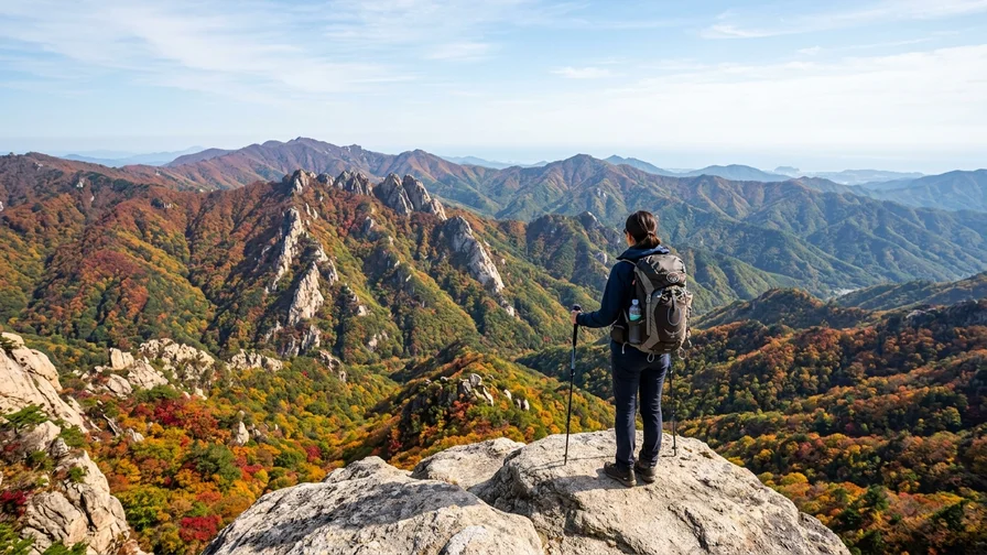
The big draw of hiking mountains in Korea is range: within about an hour of the city you can reach granite peaks, autumn ridgelines, and sunrise shelters. If it’s your first time in Korea, we’d argue that picking one mountain that fits your goal — rather than attempting a heroic traverse — is about 80 percent of a successful first hike. This guide is built to help you decide quickly which mountain suits you, then branch off to the right peak-specific or themed guide.

Why Hiking Mountains in Korea Is Having a Moment
Roughly 70 percent of South Korea is mountainous, so peaks crowd in close to the city centers. The thing that surprises first-time visitors most is this: step off the subway, walk about 10 minutes, and you’re already at a trailhead. Options run from short half-day loops to overnight traverses, so you can match the hike to your fitness and your itinerary.
K-Hiking, the K-Culture Way
As ridgelines, temples, and cable-car views from K-dramas and variety shows spread by word of mouth, hiking mountains in Korea picked up the nickname “K-hiking” among international travelers. Wrapping a hike with a cup of makgeolli — a milky, lightly sparkling rice wine — and a bowl of sanchae bibimbap (wild-vegetable rice) has become its own little cultural route, naturally bundling in the market and hot springs at the foot of the mountain. Drinking is an option, not an obligation, so if alcohol isn’t your thing, sikhye (a sweet rice punch) or barley tea does the job just fine. The point is that you can start a mountain like a casual walk around the block, not a workout. At first, aim for one ridge or one temple rather than the summit, and the pressure drops fast.
A Modern Reset in Nature
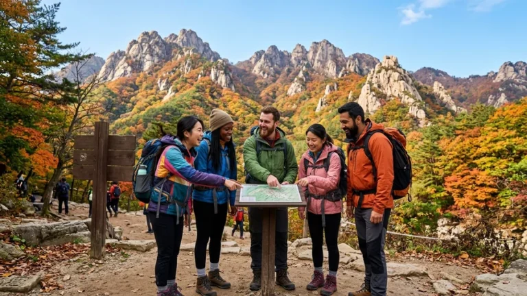
Korea’s mountains are well-maintained and well-signed, so getting lost is unlikely. National park sections post signboards at every fork showing distance, direction, and your current location number, which means even beginners can walk with confidence. Early weekday mornings are the quietest by far, while weekend mornings between 9 and 11 a.m. are the busiest, so we’d set out before the crowds. Two or three hours focused on the dirt path and the sound of a stream is a good rhythm reset, even for travelers racing through a tight schedule.
Picking a Mountain by Your Goal
Here’s a pro tip: when choosing a mountain, look at your schedule and starting point before the scenery. Below is a decision chart for which mountain to consider by goal. Detailed routes and transit for each peak go deeper in our per-mountain guides.
- Day trip from Seoul by subway, your first time: go with Bukhansan or Gwanaksan, since the subway feeds straight to the trailhead — ideal if you’re car-free.
- Autumn foliage and an easy outing: Naejangsan is famous for its tunnel of fall color and has plenty of flat strolling routes.
- Easy summit views by cable car: Gwongeumseong on Seoraksan and Naejangsan 📍 go easy on the legs, which is great for family trips.
- A big traverse, sunrise, and a mountain shelter: Jirisan is the icon for an overnight traverse and the sunrise at Cheonwangbong.
- Highland ridges, royal azaleas, winter snow: Sobaeksan, with its soft ridgelines and winter snow blossoms.
- Baengnokdam, South Korea’s highest peak, on Jeju: Hallasan tops out at 1,947 m and has routes that run on a reservation system.
- The big-picture idea of a connecting spine: the Baekdudaegan, the mountain range that links the Korean Peninsula’s backbone and a dream for long-distance trekkers.
Getting there on public transit alone, plus easing your body afterward with hot springs and forest therapy, are covered in separate themed guides. Per-mountain routes, trailheads, and timing also live in each peak’s own guide.

Beginner Mountains in Korea, Sorted by Difficulty
If you’re new to hiking mountains in Korea, it’s safest to be honest about difficulty up front. Even the same mountain can feel wildly different depending on your route, so choose your trailhead and course carefully.
Easy Walks With a Big Payoff
Naejangsan (내장산), a famous foliage spot in Jeongeup, North Jeolla Province, has a fairly flat path from the entrance gate to the cable-car station, so sneakers are fine. The crowd favorite for beginners is riding the cable car up to the observation deck and then sampling a short stretch of ridge. During peak autumn the cable-car queue gets long, so move early in the morning.
From Seoul, Gwanaksan is close to Seoul National University Station or Sadang Station on Subway Line 2, making it a solid half-day. There’s a rocky ridge section near the top that ramps up the difficulty if you go all the way, but walking only as far as a mid-mountain spring or the perimeter trail is plenty satisfying. On a first try, set your goal at the ridge viewpoint rather than the summit.
Mountains With a Tougher Challenge
Bukhansan (북한산)’s highest point, Baegundae (836 m), centers on a section just below the summit where you grab steel chains bolted into the granite and haul yourself up. Sweaty hands get slippery fast, so we’d bring even a thin pair of work gloves. Past the visitor support center there are almost no shops or flush toilets, so prep at least 1 liter of water per person in advance.
Seoraksan (설악산)’s Gongnyong Ridge or the Daecheongbong route (1,708 m), and Jirisan (지리산)’s Cheonwangbong traverse (1,915 m), are long-distance hikes of 8-plus hours, so we don’t recommend a beginner going it alone. The Cheonwangbong area on Jirisan has sections open 24 hours, but a sunrise hike requires a shelter reservation and a headlamp without exception. For these challenge routes, check trailheads and shelter-booking methods in our per-mountain guides before you plan.
Editor’s tip
For your first time, lock in “set out 7–8 a.m., be back down before 2 p.m.” as your default rhythm. Korean mountains cool off sharply after sunset and have no lighting, so a late start risks getting dark on you mid-descent. Reaching the trailhead before the crowds also makes parking and cable-car waits far easier.

Hiking Mountains in Korea Through the Seasons
Korea has four distinct seasons, so the same mountain shows a completely different face each one. That said, spring and autumn wildfire-watch closures and winter ice are variables foreign visitors easily miss, so check them without fail.
Spring Blossoms and Fresh Green
In April and May, azaleas and royal azaleas tint the ridgelines pink. The azaleas on Sobaeksan’s highland ridge and the fresh green across the Jirisan area are the headliners. But Korean national parks often fully close summit-area trails during spring (March–May) and autumn (November–December) wildfire-watch periods. Foreign travelers sometimes show up unaware of this rule and get turned back at the entrance, so before you go, confirm whether your section is closed through the Korea National Park Service’s official site. Spring has big temperature swings, so it’s smart to pack a thin windbreaker.
Winter Snow Scenes
Winter snowscapes are the highlight of hiking mountains in Korea, but rocky and high-altitude peaks carry serious ice risk. Bukhansan 📍‘s Baegundae and Seoraksan 📍‘s ridges turn treacherous when ice forms — extremely dangerous without crampons (spikes) — and some sections get closed. Sobaeksan and Hallasan 📍 deliver spectacular snow blossoms and rime ice, but you’ll need insulated gloves and a windproof jacket against high winds and hypothermia. Reservation-based routes like Hallasan need bookings even in winter, and entry-time limits shift by season, so check the official notices before you set off. The Gwongeumseong cable car on Seoraksan can stop running in high winds, so rather than banking on it, keep a walking alternative in mind to stay safe.
Difficulty and Season at a Glance
The table below summarizes the highest peak, difficulty, best season, and a one-line note for five representative mountains. Confirm exact per-route figures and trailheads in each mountain’s guide. Operating hours and closures can shift with the season.
| Mountain | Top Peak / Difficulty | Best Season / Note |
|---|---|---|
| Bukhansan | Baegundae 836 m / Moderate-Hard | Autumn / Seoul subway day trip |
| Seoraksan | Daecheongbong 1,708 m / Hard | Autumn / Gwongeumseong cable car |
| Jirisan | Cheonwangbong 1,915 m / Hard | Autumn / traverse, sunrise, shelter |
| Hallasan | Baengnokdam 1,947 m / Moderate-Hard | Winter / highest in South Korea, reservation |
| Naejangsan | Sinseonbong 763 m / Easy-Moderate | Autumn / foliage, cable car |

Reaching Korea’s Mountains by Public Transit
For first-time visitors, transit access is the heart of choosing a mountain. The easiest by a mile is Bukhansan.
- Bukhansan: Exit 1 of Gupabal Station on Seoul Subway Line 3, then catch bus 704 from the stop in front of the station — it’s about 10–15 minutes to the Bukhansanseong entrance. Buses run every 10–15 minutes on weekdays, and you board with a transit card (T-money). Alternatively, transfer at Suyu Station on Line 4 to the Ui-Sinseol line and get off at Bukhansan Ui Station, which is close to the Uidong trailhead.
- Gwanaksan: From Exit 3 of Seoul National University Station on Line 2, take village bus 5511 or 5513 to the SNU-entrance trail, or walk over from Exit 4 of Sadang Station to the Sadang trailhead.
- Naejangsan, Jirisan, Seoraksan, Hallasan: These need a transfer from an intercity bus terminal or train station onto a local city bus, which makes the route more involved. For exact lines and frequencies, search “your start → the mountain trailhead” in Naver Map or Google Maps and you’ll get live bus numbers and times.
For outlying trailheads that buses don’t reach well, a taxi or rental car is easier. For a rental car, foreign visitors need an International Driving Permit, which is not issued after you arrive in Korea — you must get it in your home country before you leave. The Kakao T taxi app often requires a Korean phone number and a domestically issued card to sign up and pay, so it’s tough for short-term travelers; also keep terminal taxi stands or hailing on the street in mind. Restaurants and ticket offices in Korea’s mountain areas are mostly Korean-only, so checking Google Maps directions and whether English support is available ahead of time makes things smoother.
Shared Gear and Trail Manners
I’ll keep the basics for hiking mountains in Korea short. For mountain-specific gear, see each peak’s guide.
- Carry at least 1 liter of water per person, because many mid-mountain stretches have no shops or drinking water.
- Wear hiking shoes with a rough, slip-resistant sole, and save sneakers for flat perimeter trails only.
- In winter or icy periods, pack crampons (spikes), since icy sections sometimes get closed.
- Pack out every bit of trash, as most summit areas have no bins at all.
- Check entry-control hours and wildfire-watch closures on the Korea National Park Service site before you set off.
- Stick to designated trails only and avoid wandering onto off-trail shortcuts.
Joining in on Sustainable Hiking
Because so many people visit Korea’s mountains, small courtesies add up to a big difference. The most basic rule is “leave it as you found it.” Even food peels and fruit seeds affect wildlife, so carry it all back out. It’s also best to avoid picking wildflowers or stacking stone towers.
Simply staying on the designated trail goes a long way toward reducing soil erosion and damage to vegetation. The spring-and-autumn wildfire-watch closures and winter ice-section closures exist to protect both nature and people, so please respect the closure notices. Reaching the trailhead by public transit cuts parking congestion and carbon emissions at the same time. Small habits are what let us walk the same ridge again next season.
More articles in this topic
- Bukhansan by Subway from Seoul — Baegundae Route and How to Get There
- Seoraksan from Sokcho — Cable Car to Daecheongbong Peak
- National Park Trekking in Korea, Reservations, Closures and Shelters
- Reach Korean Mountains by Public Transport, No Car Needed
- Hot Springs After Hiking — Recovery Spots Near Korea's Peaks
- Jirisan Hiking — Trails and Access from Nogodan to Cheonwangbong
- Hallasan Hiking to Baengnokdam via Seongpanak and Gwaneumsa
- Naejangsan Autumn Hiking by Train, Seoraebong and Sinseonbong
- Sobaeksan Hiking — Shortest Route to Birobong Peak and the Azalea Ridge
- Baekdudaegan Mountain Range, Korea's Spine and One Hike
Frequently Asked Questions
For a first time hiking mountains in Korea, which is best?
I’d recommend Bukhansan or Gwanaksan, both reachable by subway from Seoul. Access is easy and the routes range from short stretches to long challenge sections, so they’re easy to match to your fitness.
Is it okay if I don’t have dedicated hiking gear?
Flat perimeter trails are fine in sneakers, but rocky ridges and summit sections call for slip-resistant hiking shoes and at least 1 liter of water. In winter, add crampons and insulation.
Where are the toilets and drinking water on the trail?
In most cases the visitor support center at the trailhead has the last flush toilet, and summit areas often have no shops or drinking water. Pack enough water and snacks before you start.
What does it mean that summits can be closed in spring and autumn?
Korean national parks often close summit-area trails during the spring (March–May) and autumn (November–December) wildfire-watch periods. Check closure status on the Korea National Park Service’s official site before you hike.
Fold the map away for a moment, pick the one mountain that fits you from today’s decision chart, and just sketch out the route to the trailhead. Double-check closures and operating hours on the Korea National Park Service site beforehand, and your first hike will feel a whole lot safer.