Bukhansan by Subway from Seoul — Baegundae Route and How to Get There
목차
Quick Summary
- Bukhansan 📍 is an 836m mountain you can reach from central Seoul using only the subway and city buses, and admission is free.
- The shortest route to the summit of Baegundae starts from Bukhansan Ui Station 📍. This Ui-dong route, including the roughly 2km walk from the station to the trailhead (Baegundae Trail Support Center), comes to about 7km round trip and is comfortable in 3 to 4 hours.
- The final rocky ridge has steel railings and footholds, so even beginners can manage it, but be sure to bring non-slip hiking shoes.
Many first-timers don’t realize you can stand on a genuine rocky peak just an hour by subway from the heart of Seoul. Bukhansan hiking is a perfect fit for international travelers exploring on foot without a car. Follow this single guide and you can make it to the summit of Baegundae without getting lost on your very first day. We’ve laid out the transit for each trailhead, the routes, and the safety tips in order. See our Pillar article for an overview of trekking Korea’s famous mountains.
Bukhansan Hiking at a Glance
Before you actually set off, it helps to get a feel for what kind of mountain Bukhansan is by looking at a quick table. It straddles northern Seoul and Goyang in Gyeonggi Province, and its highest peak, Baegundae, stands at 836m. As a national park, it has no admission fee, and anyone can climb it without a reservation in advance. That said, the peaks are all massive granite rock, which gives the mountain a very different character from Korea’s other soil-covered mountains. People often think “the mountain isn’t that high, so sneakers should be fine,” then find themselves caught off guard at the rocky section just below the summit. A good pair of hiking shoes completely changes the quality of the climb.
| Category | Details | Notes |
|---|---|---|
| Location | Northern Seoul and Goyang, Gyeonggi Province | Excellent access from the city |
| Highest peak | Baegundae, 836m | Rocky ridge at the summit |
| Ui-dong route | About 7km round trip from the station, 3 to 4 hours | Low difficulty, recommended for beginners (includes about 2km on foot to the trailhead) |
| Bukhansanseong 📍 route | 3.4km one way, 2 hours 40 minutes | Intermediate, fortress walls and valley (from the trail support center) |
| Sumeunbyeok route | About 4.5km one way, around 3 hours | Advanced difficulty, for experienced hikers |
| Admission | Free | No reservation currently required (worth confirming at the time of your visit) |
| Best seasons | Spring and fall | Crowded on weekends during foliage season |
Keep this table in mind and you’ll quickly figure out which route suits you. If it’s your first time, choose the Ui-dong route; if you’d like to take your time enjoying the fortress walls and valley scenery, go for the Bukhansanseong route. Saving the location of Bukhansan on your map in advance makes planning your route much easier.
How to Get There: Transit by Trailhead
Half of Bukhansan hiking comes down to finding the right trailhead. The subway station you start from changes completely depending on which peak and which route you climb. For the easiest way up to Baegundae, head to the Ui-dong trailhead; to climb alongside the fortress and valley, go to the Bukhansanseong trailhead. The base fare for a Seoul city bus is 1,500 won with a transit card, and it transfers to the subway and light rail, so with a single rechargeable transit card you’ll rarely worry about transfers.
Ui-dong Trailhead: The Shortest Route to Baegundae
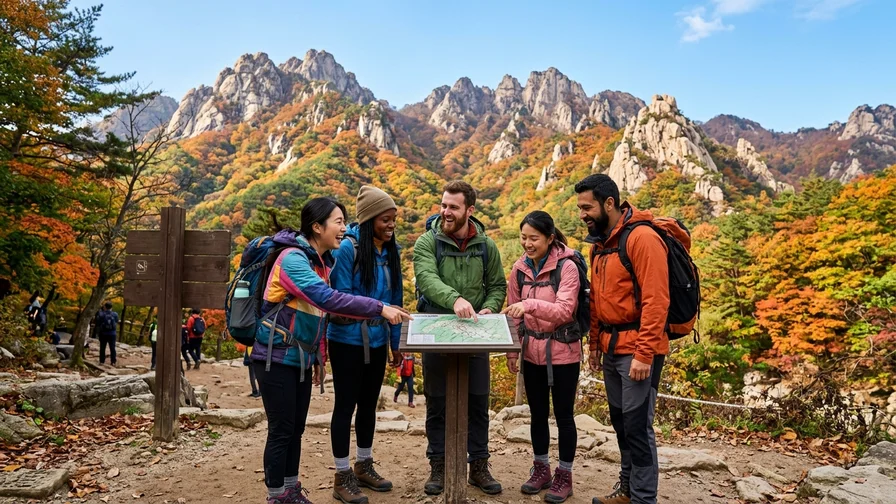
This is the starting point of the shortest and easiest way to Baegundae. Take the Ui-Sinseol light rail line to Bukhansan Ui Station, leave by Exit 2, and walk about 1.8 to 2km (30 to 40 minutes) along a flat paved road to reach the main trailhead at the Baegundae Trail Support Center. If you came on Line 4, get off at Suyu Station Exit 3, take bus 120 or 153, and get off at the Ui-dong terminal. You may memorize the bus number yet still struggle to find the stop, so search for “Bukhansan Ui Station” on Naver Map or KakaoMap and you’ll get real-time arrival info as well, which keeps you from getting lost. Once you exit, just follow the people in hiking gear and you won’t have much to worry about.
Bukhansanseong Trailhead: The Fortress and Valley Route
This is the starting point of the standard route that climbs alongside Bukhansanseong Fortress and the valley. Leave Gupabal Station (Line 3) by Exit 1, take bus 704 or 34, and get off at the Bukhansanseong Entrance stop. Bus 704 runs about every 16 minutes on weekdays, so it’s best to give yourself plenty of time. Bus numbers and live schedules can change, so search “Gupabal Station → Bukhansanseong Entrance” on KakaoMap or Naver Map and check once more before you leave. On weekend mornings buses can pass by full of hikers, so letting one bus go and catching the next is also an option.
Pre-Hike Checklist
When transferring from the subway to the bus, you have to tap your transit card again for the transfer discount to apply. When you hear the announcement “hwanseung-imnida” (this is a transfer), almost no extra fare is added, so you can relax. For the bus driver, a simple “kamsahamnida” (thank you) is enough.
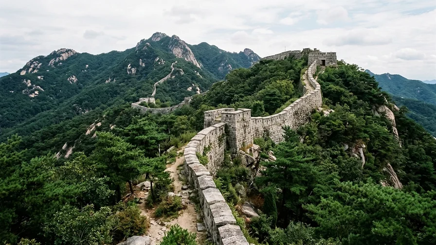
Rough Budget: Bukhansan has no admission fee, and you can reach the trailheads by subway and city bus. Seoul city buses (704, 34, and so on) cost about 1,500 won by card and transfer with the subway. With no separate tickets or cable cars, there are almost no costs beyond transit.
Walking the Route: Up to the 836m Baegundae Summit
Now we head into the mountain proper. The highlight of Bukhansan hiking is ultimately the Baegundae summit, so let’s go through the three main routes in order of difficulty. Picking just one to match your fitness and experience is plenty.
From Ui-dong over Harujae to Baegundae
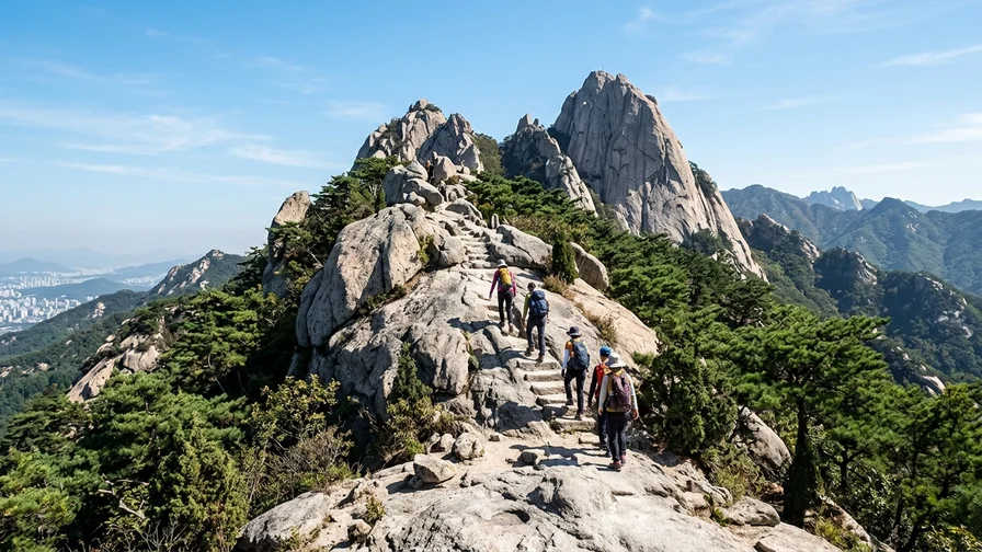
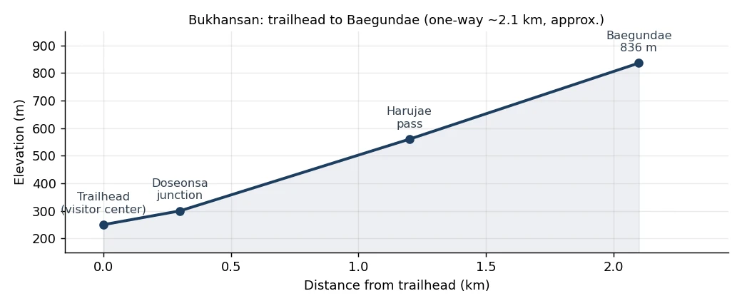
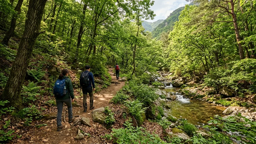
This route starts at Bukhansan Ui Station, turns toward the Baegundae Trail Support Center at the Doseonsa Temple 📍 junction, then crosses Harujae and climbs to Baegundae. Just remember that you don’t pass through the temple grounds themselves; you branch off onto the mountain path at the junction in front of the temple. From Bukhansan Ui Station to the trailhead (Baegundae Trail Support Center), you walk about 2km of flat paved road for 30 to 40 minutes, and from there it’s about 2km one way to Baegundae. Starting from the station and returning to it comes to about 7km round trip in 3 to 4 hours. Since the difficulty is on the low side, this is the route we most recommend for beginners. The gentle paved road up to the trailhead is good for warming up, and the real climb begins once you cross Harujae. Just before Baegundae there’s a rocky ridge section where you grip steel railings and footholds set into the granite, but don’t panic here. Hold the rope and just watch where you place your feet, and anyone can make it up. From the summit, Insubong and central Seoul spread out before you, so the reward is enormous for such a short distance.
The Standard Route up the Bukhansanseong Fortress Wall
This route starts at the Bukhansanseong Entrance, passes Daeseomun and Jungseongmun, follows the Bukhansanseong Fortress wall path, then climbs the steep “Kkalttak Pass” from Yaksuamteo to Wimun (Baegunbong Ammun) before heading to Baegundae. It’s longer than the Ui-dong route, but it offers richer sights to match. Walking alongside the old fortress’s stone walls and the sound of the valley stream, you’ll lose track of time. The section climbing along the wall from Daeseomun gets gradually steeper, so bring water and snacks and rest along the way. Because the path runs beside the valley, it’s cool in summer, but the rocks get slippery after rain, so you’ll need to be extra careful with your footing. This is a good route for those who want to take in both the scenery and the history.
Sumeunbyeok Ridge: An Advanced Route for Experienced Hikers
This advanced route starts at Bamgol, follows the Sumeunbyeok ridge, and climbs to Baegundae over about 4.5km in roughly 3 hours. With cliffs on both sides of the ridge it offers thrilling views, but it’s correspondingly dangerous, so we only recommend it to those with hiking experience. There are many sections where you climb up and down using your hands on the rock, which calls for fitness and a sense of balance. If you’re a beginner, save this route for another time and experience Baegundae via the Ui-dong route first. The Sumeunbyeok ridge gives you scenery you won’t forget once you’ve climbed it, but not overdoing it is always the right call in the mountains.
🧭 Which Way Down: Out-and-Back or Traverse
If it’s your first time, going up via Ui-dong and coming back down the same way is the simplest. You won’t get confused on a path you’ve already walked, and the transit is the same. If you want a change of scenery, a traverse from Ui-dong over Baegundae and down toward Bukhansanseong is a good choice, letting you see fortress walls and valley scenery different from the way up. Just note that your descent trailhead changes to the Bukhansanseong Entrance, so check the buses toward Gupabal Station for your return in advance.
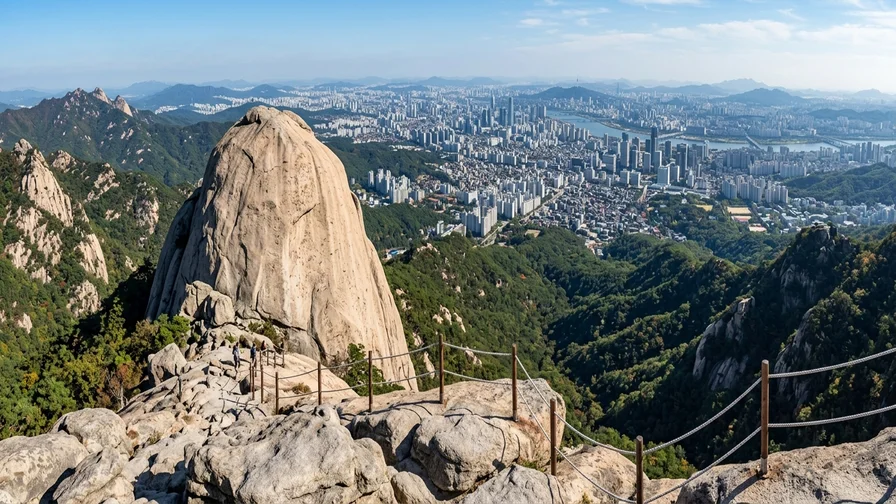
The 100 to 200 meters just below the Baegundae summit are this mountain’s real highlight and its scariest section. You grip the steel railings set into the sheer granite slab with both hands and step up one foot at a time, and with the open exposure below, your legs may shake the first time. Even so, the footholds and steel ropes are well maintained, so if you don’t rush and take it slowly, even beginners can make it up. The descent is actually the more cautious part, so turn around, hold the steel rope, and come down one step at a time.
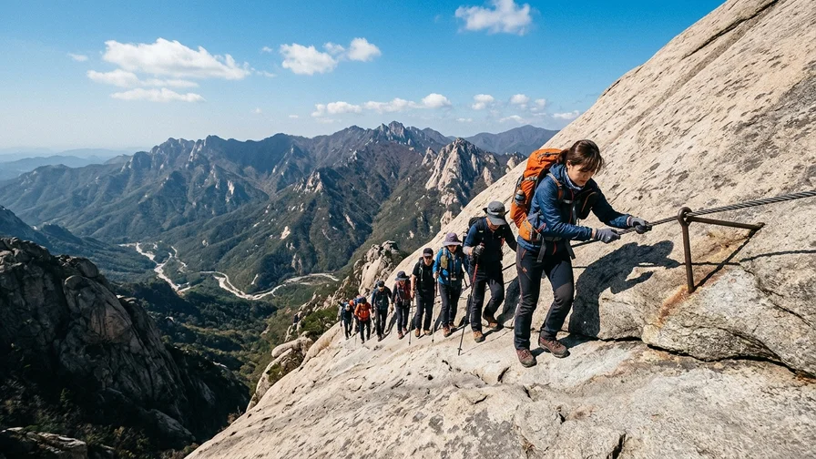
🧤 Gloves Are Essential for the Summit Steel-Rope Section
Holding the steel railing bare-handed for long hurts your hands, and on cold days the cold metal makes you slip. Even simple work gloves will do, so be sure to bring gloves. To keep both hands free, fold your trekking poles into your backpack, and secure your phone or camera with a wrist strap or in a pocket for safety.
What You’ll Encounter on Bukhansan
This is exactly why Bukhansan hiking isn’t just about tagging the summit and heading down: history and nature unfold along every stretch of the trail. The first thing you’ll come across is Bukhansanseong Fortress. Built during the Joseon era to protect the capital, its wall path follows the ridgeline, and walking it feels like tracing the footsteps of people from the past. Fortress gates like Daeseomun remain intact, making for good photos as well.
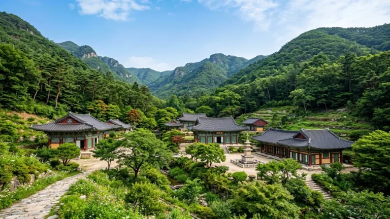
On the Ui-dong route you’ll pass Doseonsa Temple. A thousand-year-old temple set on Samyang-ro 173-gil in Gangbuk-gu, Seoul, it’s a good place to stop and settle your mind before or after the hike. The temple’s quiet atmosphere makes the start and end of your climb feel calm.
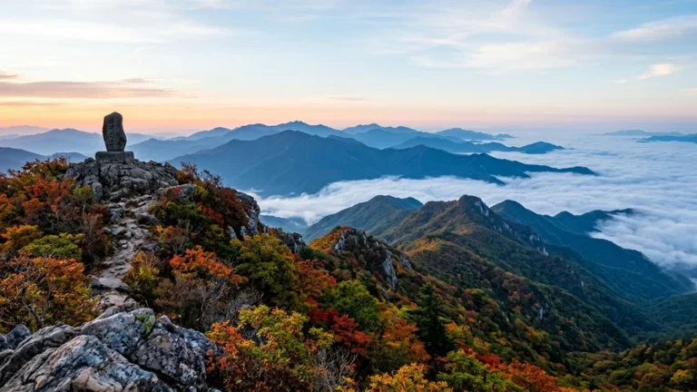
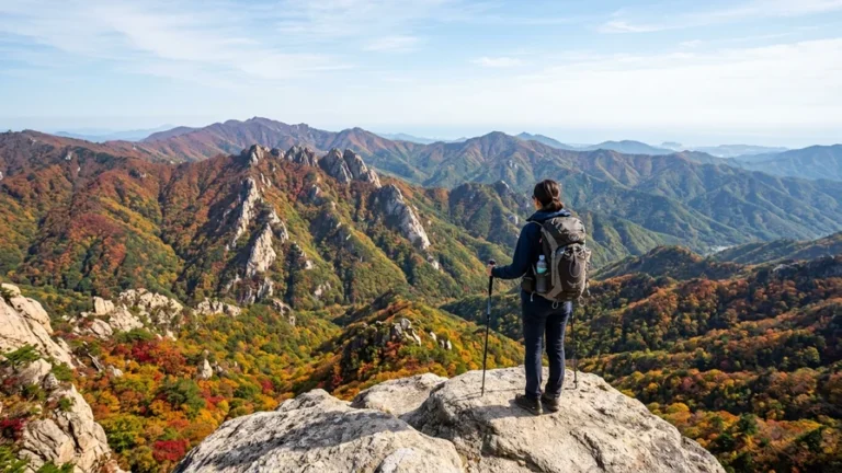
And then there are the true stars of Bukhansan, the Baegundae and Insubong rock peaks. The sight of giant slabs of granite soaring toward the sky has an overwhelming presence you have to see for yourself. Insubong in particular is a mecca for rock climbers, so if you’re lucky you may spot climbers clinging to the cliff.
Safety, Seasons, and Preparation: Bukhansan-Specific Tips
Bukhansan may look low, but its peaks are all rock, so what you need to bring differs a little from other mountains. The most important thing is footwear. The rocky ridge near the summit is smooth granite, so hiking shoes with good grip are essential. Sneaker soles slip easily on rock, so secure your safety with hiking shoes that have non-slip soles.
- In winter, the rocks and shaded sections freeze over and become very slippery, so you must bring crampons.
- During the summer monsoon, valley water rises and the rocks get wet and dangerous, so it’s best not to push it on days with rain in the forecast.
- On weekends and during foliage season, hikers crowd in heavily and you may even have to line up and wait at the summit ridge, so starting early in the morning makes things far more relaxed.
- Bringing gloves makes your hands hurt less and reduces slipping when you grip the steel railing.
- Descending after dark is dangerous, so work backward from sunset and plan your schedule with plenty of margin.
- In spring and fall the temperature swings are large, and the Baegundae summit is an exposed rock area, so it runs about 5 degrees cooler than the city with strong winds that drop the perceived temperature sharply. Even in summer, be sure to bring a windbreaker layer.
Bring plenty of water, but since there are no shops near the summit, it’s easiest to buy it at the trailhead in advance. Many people assume they can buy some on the mountain and end up suffering from thirst, so make a habit of stocking up at a convenience store before you set off.
⚠️ There Are No Restrooms or Shops on the Mountain
The restroom at the trail support center at the entrance is the last flush toilet. There are no restrooms, shops, or water fountains at all on the way up to Baegundae or near the summit, so use the restroom at the trailhead first and bring at least 1 liter of water per person. On hot days or if you sweat a lot, having up to 2 liters will give you peace of mind. If you drive, you can use Bukhansanseong Parking Lots 1 and 2 (paid) on the Bukhansanseong side and the Doseonsa entrance parking lot on the Ui-dong side, but they fill up quickly on weekend mornings, so public transit is more convenient.
❄️ Without Crampons, Winter Is Dangerous
Since Bukhansan’s peaks are all rock, thin snow and ice from December through early March are the most dangerous. When the granite slab just below the summit freezes, it’s hard to climb without crampons, and on heavily iced days safety staff may stop hikers without crampons from reaching the summit or close off parts of the trail. For a winter hike, be sure to bring crampons and gloves.
⛔ Trail Access Hours and Wildfire-Prevention Closures
National parks have set hours during which you can enter. Generally you can only climb from after sunrise until before sunset, and in winter the window is shorter. Also, during wildfire-prevention periods in spring (roughly February to May) and fall (around November), some trails may be closed. Some international travelers really do show up without knowing and have to turn back at the entrance, so before your visit be sure to check the closures for the day and the entry hours on the Korea National Park Service website or by calling their center (1670-9201).
Official Links: For the latest trail status, closures, and operating hours, always check the official Korea National Park Service website before you go: english.knps.or.kr. To reserve free rental gear like hiking boots or crampons (in winter), visit the Seoul Public Service Reservation website: yeyak.seoul.go.kr (The website is primarily in Korean, so using a browser translator is recommended).
🥾 No Hiking Shoes? Borrow Them for Free
It’s okay if you don’t have gear. Places like the Bukhansanseong Trail Support Center lend out safety equipment such as hiking shoes, poles, crampons, and knee guards for free (Seoul’s free hiking gear rental, generally operating 09:00–17:00). Sizes and stock are limited, so it’s best to reserve ahead or visit early, and confirm the operating hours and available items at the time of your visit.
🆘 Emergencies: 119 and Location Signs
If an accident happens, call 119. There are location signs marked with national point numbers throughout the trails, so if you read that number to 119, the rescue team can quickly pinpoint your exact location. If Korean is difficult, you can get three-way interpretation in English and other languages through the BBB interpretation service (1588-5644). Saving 119 and 1588-5644 on your phone before you set off will give you peace of mind.
After the Hike: Food in Ui-dong and Gupabal
Bukhansan has developed local food scenes at each trailhead. The Ui-dong side is known for valley baeksuk (chicken soup) and handmade tofu, while the Bukhansanseong Entrance side is famous for hand-cut noodles made for hikers. Choose based on your descent route. Places like mountain lodges and baeksuk restaurants sometimes don’t take cards or prefer cash, so carrying a little cash will put your mind at ease.
Dietary Note for Vegetarians & Allergies: Be aware that many Korean dishes contain hidden animal products. For example, ‘Haemul-pajeon’ (해물파전) is a seafood pancake. Even seemingly vegetarian dishes like ‘Dubu-jjigae’ (tofu stew) or vegetable side dishes often use a meat or fish-based broth or are seasoned with fermented seafood (jeotgal). To request a purely plant-based meal, you can ask: “고기나 해산물 없이 가능한가요? (Gogi-na haesanmul eopsi ganeunghangayo?)”, which means “Is it possible without meat or seafood?”. Success may vary by restaurant.
- Dangun Sanjang 📍 (Ui-dong valley) is known for chicken baeksuk simmered slowly with medicinal herbs, great for restoring the energy a hike drains. Pairing a seafood pajeon with a glass of makgeolli makes a fitting finish to your climb.
- Sandubu-jip 📍 (Ui-dong) serves handmade tofu made fresh daily and tofu hot pot, both clean-tasting and filling, well suited for when you want a meal that satisfies without weighing you down.
- Uri-kong Sundubu 📍 (Ui-dong) is popular for sundubu (soft tofu stew) and tofu hot pot made with Korean-grown soybeans, with a spicy, warming broth that’s especially welcome after a hike on a cold day.
- Mirim Sanjang 📍 (Ui-dong) serves chicken baeksuk and wild-greens dishes in a mountain-lodge setting beside the valley, a good spot to sit around with your group and rest at a leisurely pace.
- Bukhansan Son-kalguksu 📍 (Bukhansanseong Entrance) serves hand-cut noodles with house-made noodles, a good way to wrap up with a bowl of hot broth if you descended via the Bukhansanseong route.
Frequently Asked Questions (FAQ)
Can foreign beginners do Bukhansan hiking?
Yes, the Ui-dong route is well within reach. Starting from the station and returning to it takes about 3 to 4 hours round trip, and since the difficulty is on the low side, even first-time hikers can manage it. Just note there’s a rocky ridge section right below the summit, so be sure to wear hiking shoes.
Do I need an admission fee or an advance reservation?
Bukhansan is a national park but admission is free, and currently anyone can climb it without a separate reservation. That said, like some national parks the trend is moving toward reservation systems, so checking the Korea National Park Service site at the time of your visit is the safe move. As long as you’ve got your gear sorted, you can just head out.
Is going by subway really convenient?
Absolutely. The shortest route to Baegundae connects directly from Exit 2 of Bukhansan Ui Station on the Ui-Sinseol line, and the Bukhansanseong route is just one bus ride from Gupabal Station on Line 3. You won’t find it inconvenient at all without a car.
When is the best time to go?
Spring and fall are best. The fall foliage scenery is especially stunning, but that also means weekends get crowded. If you want to enjoy it in peace, we recommend early on a weekday morning.
If you’ve followed along this far, your Bukhansan hiking preparations are complete. Before you set off, check the day’s mountain weather on the official Korea Meteorological Administration site, then head out. For more Korea travel information, see more on Come On Korea, and if you’re curious about the full picture of which of Korea’s famous mountains to climb first and how, continue to the full Pillar article. Follow this just as it is, and you won’t get lost on your first day.
Related reads in this series
- Hiking Mountains in Korea, How to Pick Your First Peak
- Seoraksan from Sokcho — Cable Car to Daecheongbong Peak
- National Park Trekking in Korea, Reservations, Closures and Shelters
- Reach Korean Mountains by Public Transport, No Car Needed
- Hot Springs After Hiking — Recovery Spots Near Korea's Peaks
- Jirisan Hiking — Trails and Access from Nogodan to Cheonwangbong
- Hallasan Hiking to Baengnokdam via Seongpanak and Gwaneumsa
- Naejangsan Autumn Hiking by Train, Seoraebong and Sinseonbong
- Sobaeksan Hiking — Shortest Route to Birobong Peak and the Azalea Ridge
- Baekdudaegan Mountain Range, Korea's Spine and One Hike