Sobaeksan Hiking — Shortest Route to Birobong Peak and the Azalea Ridge
목차
Quick Summary
- The highest peak for Sobaeksan 📍 hiking is Birobong 📍 (1,439m), and the fastest way to the summit is via the Euigok and Cheondong routes on the Danyang side
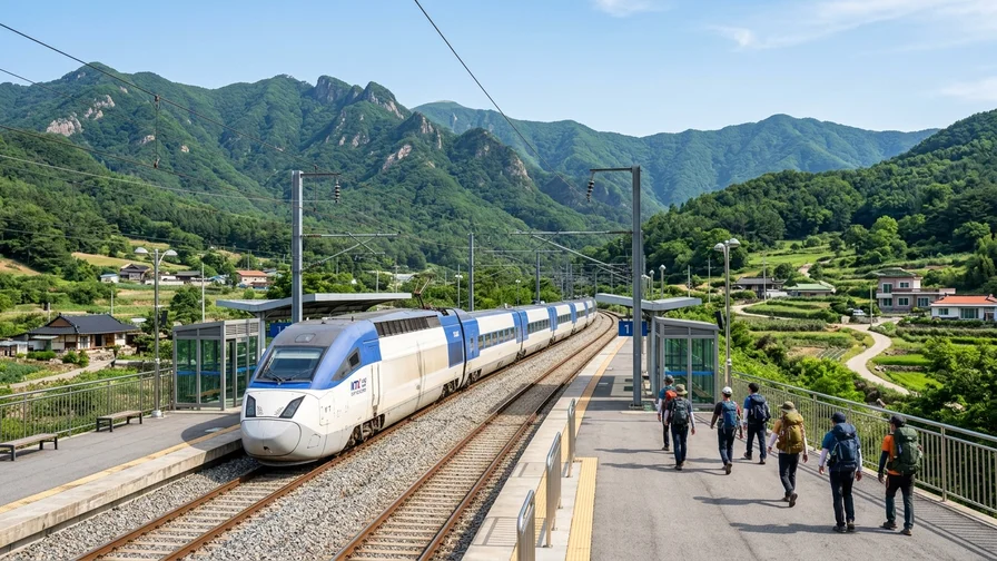
- With the KTX-Eum on the Jungang Line stopping at Punggi and Danyang stations, you can reach the trailhead area in roughly 1 hour 40 minutes to 2 hours from Cheongnyangni. There is no cable car, and admission is free
- The azalea ridge running from Birobong to Gukmangbong peaks in late May, while winter is famous for biting winds and rime ice (sanggodae), so a windproof shell and crampons are a must
If you’ve just arrived in Korea and are planning a Sobaeksan hiking trip, this single guide will help you sort out everything from choosing a trailhead to your train and bus connections, the azalea season and winter safety, and even a hearty garlic set meal in Danyang after you come down. Sobaeksan 📍 is less a rugged rocky peak and more a high-plateau mountain with gently flowing ridgelines, which makes it one of Korea’s famous mountains where a foreign beginner can take in a summit view relatively easily. Just follow along in the order below.
Sobaeksan at a Glance
Sobaeksan straddles the border between Danyang County in North Chungcheong Province and Yeongju City in North Gyeongsang Province, and it was designated a national park in 1987. Centered on its highest peak, Birobong 📍 (1,439m), it connects to Yeonhwabong 📍 (1,383m) and Gukmangbong (1,420m) along the Baekdudaegan ridgeline. First, take a quick look at the distance and difficulty of each route.
| Route | Destination peak / Distance | Time / Difficulty |
|---|---|---|
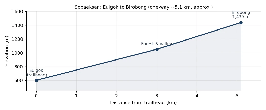
| Euigok | Birobong / 5.1km one way | About 2 hr 40 min / Intermediate |
| Cheondong | Birobong / 6.8km one way | About 3 hr / Intermediate |
| Jungnyeong | Yeonhwabong / About 7km | About 3 hr / Gentle |
| Huibangsa | Yeonhwabong / About 7.4km round trip | About 3 hr 30 min / Intermediate |
- It sits on the border of Danyang (North Chungcheong) and Yeongju (North Gyeongsang), with Birobong at 1,439m as the highest peak
- There is no cable car, and as a national park, admission is free
- Royal azaleas peak in late May, and the best seasons are spring azaleas, autumn foliage, and winter snowscapes
- There are no shops or water dispensers at the summit or along the ridge, so bring at least 1 liter of water per person from the trailhead
How to Get to Sobaeksan (Transport)
Access for Sobaeksan hiking improved greatly once the KTX-Eum on the Jungang Line began stopping at Punggi, Danyang, and Yeongju stations. From Cheongnyangni, it takes about 1 hour 40 minutes to 2 hours to reach Punggi or Danyang. Depending on your trailhead, you’ll head to either the Punggi side or the Danyang side, so choose your station to match the route you plan to hike.
Huibangsa Trailhead (Yeonhwabong, Punggi side)
From Punggi Station, take the No. 25 (Huibangsa, Punggi) local bus, get off at the Huibang stop, and it’s about a 10-minute walk to the Huibang Visitor Support Center 📍. For exact schedules and fares, search “Punggi Station to Huibang Visitor Support Center” on Naver Map to see real-time bus numbers and frequencies (this is more reliable than listing a number that may be wrong).
Jungnyeong Trailhead (Yeonhwabong, Danyang side observatory road)
From Danyang Station, local buses to the Jungnyeong Rest Area 📍 run roughly once an hour and take about 40 minutes. Jungnyeong 📍 is about 25km from Danyang Station and about 18km from Punggi Station, so many people use a taxi. If the bus timing is awkward, grabbing a taxi in front of Danyang Station is faster.
Cheondong and Euigok Trailheads (Shortest to Birobong, Danyang side)
The Cheondong Visitor Support Center is about a 20-minute taxi ride from Danyang Station. The Euigok Visitor Support Center 📍 (842 Saebat-ro, Gagok-myeon, Danyang-gun, North Chungcheong) has weak public transport, so a taxi from Danyang Station is the practical option.
Here’s an important note for foreign travelers. The Kakao T taxi app often requires a Korean phone number and a domestically issued card to sign up and pay, which makes it hard for short-term travelers to use. Catching a taxi at the Danyang Station taxi stand or asking your accommodation to call one is the surer bet. Since these are remote trailheads, a rental car is also a good choice, but foreigners need an International Driving Permit, and you cannot get one issued after arriving in Korea, so be sure to obtain it in your home country before you leave. For directions, Google Maps is the easiest to follow.
On-the-ground tip
If you’re only after the summit view, choose Euigok; if you’re worried about your knees or want a gentler walk, choose Cheondong. Both trailheads connect to Danyang Station by taxi, so staying in downtown Danyang the night before and taking an early-morning taxi to the trailhead makes for the cleanest itinerary. For a pre-dawn start, booking accommodation near Danyang Station the night before makes catching that first taxi much easier.
Walking the Routes: The 4 Main Sobaeksan Trails
Sobaeksan hiking feels completely different depending on your trailhead. Let us walk through the four official routes in order: Euigok and Cheondong, which head straight to Birobong, and Jungnyeong and Huibangsa, which pass by Yeonhwabong.
1. Euigok Route: Shortest to Birobong, the Fastest Way to the Summit
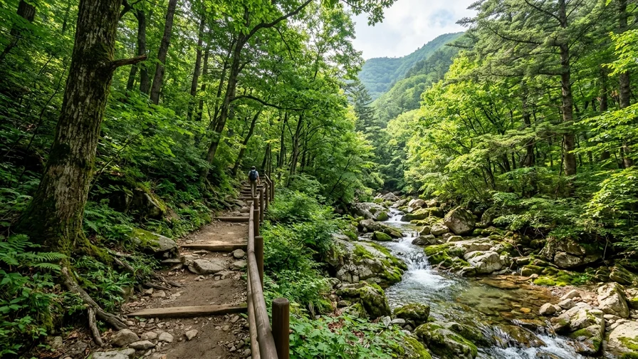
From the Euigok Visitor Support Center to Birobong, it’s 5.1km one way, about 2 hours 40 minutes, intermediate difficulty. It’s the quickest of the four routes to reach the summit. The appeal of this route is passing through old-growth forest and a clear valley that see fewer crowds and less wear. If you’d like a quiet forest walk before the crowds arrive, Euigok is ideal. That said, the latter half is steep, so don’t underestimate it just because it’s labeled the “shortest.”
2. Cheondong Route: The Gentlest and Most Manageable
From the Cheondong Visitor Support Center to Birobong, it’s 6.8km one way, about 3 hours, intermediate difficulty. It’s longer than Euigok, but the gentler grade lets even first-timers reach the Birobong summit relatively easily. It’s also popular as a descent route since it’s easy on the knees. The early forest path along the Cheondong Stream is soft underfoot.
3. Jungnyeong Route: Yeonhwabong via the Observatory Service Road
From the Jungnyeong Visitor Support Center 📍 to Yeonhwabong 📍 is about 7km, around 3 hours. It’s a paved service road for the observatory and communication facilities, so the grade is gentle and the walking is easy, though some find the scenery a bit monotonous. On the upside, there’s almost no chance of getting lost, making it a safe choice for beginners or cloudy weather. If you continue along the ridge from Yeonhwabong to Birobong, it becomes a full traverse.
4. Huibangsa Route: Waterfall and Temple
From the Huibang Visitor Support Center 📍, passing Huibang Falls 📍 and Huibangsa Temple 📍 on the way to Yeonhwabong, it’s about 7.4km round trip, around 3 hours 30 minutes, intermediate difficulty. The scenery, combining a refreshing waterfall about 28m high with a mountain temple, is lovely, but there’s a steep “Kkalttak Gogae” (gasping-for-breath) section midway that leaves you panting. Hiking poles make it much easier.
On-the-ground tip
For a traverse, a popular plan is to ascend from Jungnyeong, tag Yeonhwabong and Birobong, then descend via Cheondong or Euigok. Note that your descent trailhead shifts to the Danyang side, so if you left a car at Jungnyeong, plan a loop back to your start; if you’re on public transport, factor in a taxi to Danyang Station after the traverse. The most manageable recommendation is a Cheondong out-and-back to Birobong only.
What You’ll See on Sobaeksan
The real reward of Sobaeksan hiking lies at the summit. Here are five things you shouldn’t miss up there.
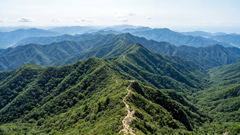
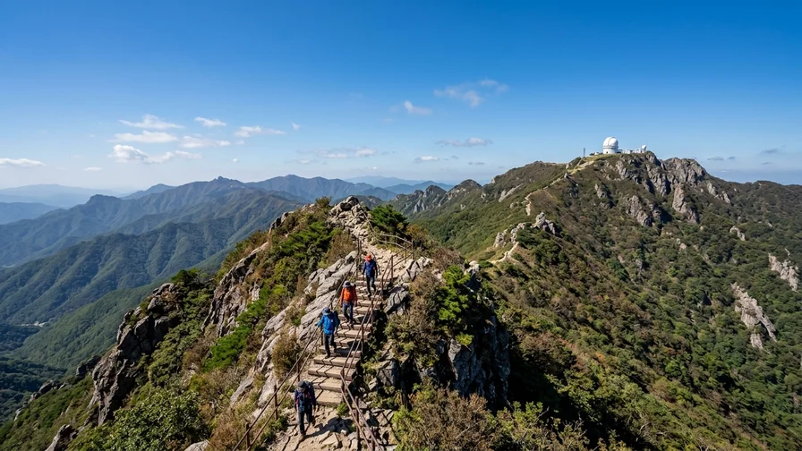
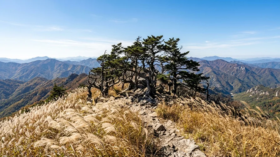
- The summit area is a vast, sparsely treed high-plateau meadow. The wide-open view, with ridgelines rolling like waves in every direction, is the highlight. Since there are no tall trees, you take the wind head-on, so a windbreaker is needed even in summer
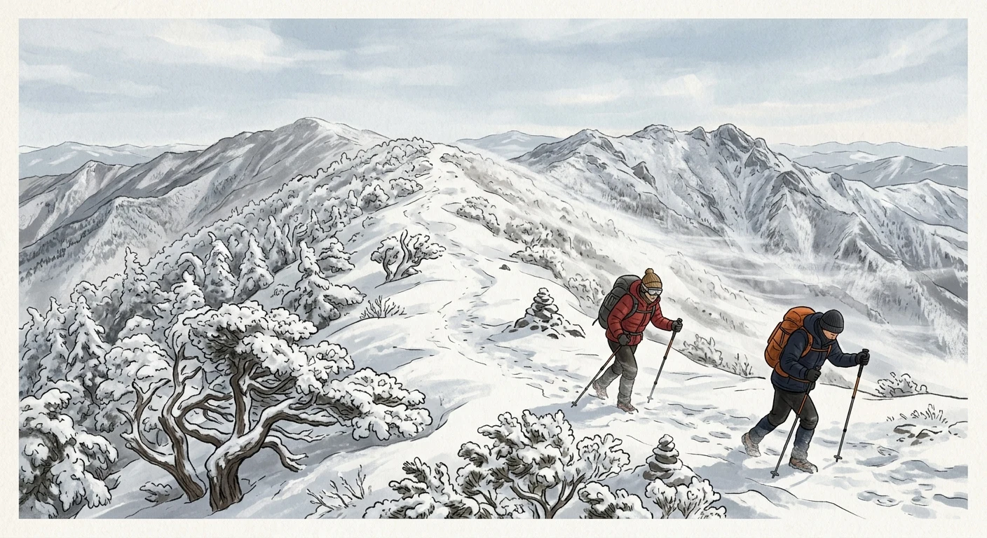
- The yew (jumok) grove on the Birobong ridge is a Natural Monument. These ancient trees, said to “live a thousand years and stand another thousand after death,” guard the ridge, and when winter rime ice settles on them, they become a picture-perfect scene
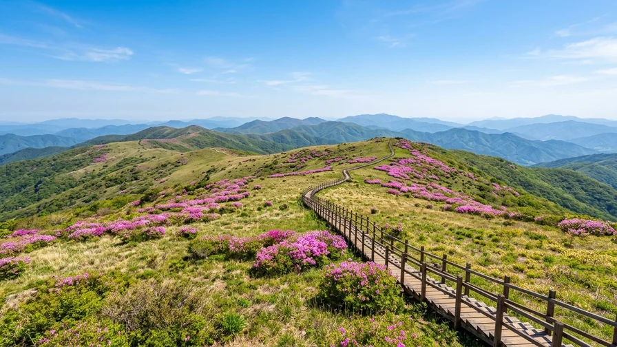
- The ridge from Birobong to Gukmangbong is blanketed in pink azaleas in late May (more in the seasonal section below)
- The Sobaeksan Observatory 📍 (Sobaeksan Optical Astronomy Observatory) near Yeonhwabong is an observation facility run by the Korea Astronomy and Space Science Institute, and it was Korea’s first national observatory. You’ll naturally pass it if you climb via the Yeonhwabong route
- Jungnyeong 📍 (689m) is an old pass that once connected the Yeongnam and Chungcheong regions, and the old Jungnyeong trail still remains today. Temples such as Birosa, Choamsa, and Guinsa (the head temple of the Cheontae order) are scattered across the mountain’s slopes
Azalea Season and a Four-Season Guide
The highlight of Sobaeksan hiking is unquestionably the azaleas. Royal azaleas peak in late May, and because of the high elevation, they bloom later than in the lowlands. The ridge from Birobong to Gukmangbong fills with pink azaleas, and around this time the Danyang Sobaeksan Azalea Festival and the Yeongju Sobaeksan Azalea Festival take place. Check the annual announcements from Danyang County and Yeongju City for exact bloom timing and festival dates (blooming can shift a few days earlier or later depending on the year’s weather).
Beyond the azaleas, all four seasons are rewarding. Summer brings wildflowers, autumn brings foliage and silver grass, and winter brings snowscapes and rime ice in turn. In particular, the high-plateau ridge with autumn silver grass swaying in the wind, and the winter rime ice, are scenes unique to Sobaeksan. You can gauge Korea’s foliage and bloom timing using data from the Korea Meteorological Administration. A general overview of Sobaeksan is available on Wikipedia.
Safety, Seasons, and What to Pack
Sobaeksan is famous for its biting winter winds. The northwesterly wind on the Birobong and Yeonhwabong ridges is fierce, dropping the wind-chill sharply, so for a winter hike a windproof shell, crampons, gloves, and a hat are essential, and it’s best not to linger long on the ridge. The rime ice and snowscapes are stunning, but trails are frequently closed when the weather turns bad. Be sure to check for closures on the Sobaeksan National Park website the day before and the day of your hike.
There’s also a system that foreigners often don’t know about. Korea’s national parks frequently close summit and high-elevation trails entirely during wildfire-prevention periods in spring (usually March to May) and autumn (November to December). If you plan to go during these periods, it’s safest to check the relevant section’s closure status in advance on the Korea National Park Service website. See the Sobaeksan National Park information page.
Here’s a summary of supplies and facilities, too.
- There are no shops or water dispensers at the summit or along the ridge. Bring at least 1 liter of water per person and prepare snacks at the trailhead in advance
- Restrooms exist only at visitor support centers and a few facilities. Using the trailhead restroom before you set off is your last chance
- Pack out your trash as a rule. Snacks that are easy to carry back are more convenient than disposable lunchboxes
- For a rough budget, a Punggi Station local bus runs around 1,500 won (transit cards accepted), while taxis vary by distance and time, so check the estimated fare with a navigation app in advance. Admission is free, and there’s no separate summit-certification program
After the Descent: Danyang Garlic Set Meals and Punggi Ginseng
Once you’ve finished your Sobaeksan hike, rounding things off with a hearty local specialty is the way to go. Danyang is known for garlic set meals and garlic tteok-galbi, while Punggi is famous for ginseng. We’ll introduce only verified, real restaurants (prices and hours can change, so check on Google Maps before visiting).
- Jangdari Restaurant (Jangdari Maneul Yakseon) 📍: 370 Sambong-ro, Danyang-eup, Danyang-gun, North Chungcheong. Known for a medicinal-herb (yakseon) set meal made with garlic. It comes in a Korean full-course style with many side dishes, great for replenishing after a hike.
- Seongwon Maneul Yakseon Yori 📍: 59 Sambong-ro, Danyang-eup, Danyang-gun, North Chungcheong. A restaurant serving medicinal-herb dishes that make use of Danyang garlic, located downtown near Danyang Station.
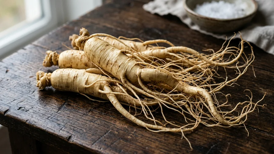
- Punggi Insam Galbi 📍: 237-2 Dongbu-ri, Punggi-eup, Yeongju-si, North Gyeongsang. A spot where you can enjoy Punggi ginseng together with galbi, which fits your route if you came down via the Punggi-side Huibangsa or Jungnyeong trails.
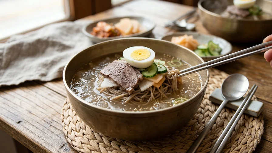
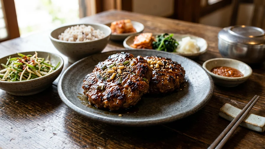
If you’re craving a noodle dish, another option is Seobu Naengmyeon 📍 in Punggi, famous for its cold buckwheat noodles (26 Insam-ro 3beon-gil, Punggi-eup, Yeongju-si, North Gyeongsang). The garlic tteok-galbi in Danyang’s garlic set meal is a grilled minced-rib patty made by mixing Danyang garlic into the minced meat. Traditional-market stalls and old-school eateries often don’t take cards and accept cash only, so carrying a little cash is the safe bet. Many places have no English menu, so make use of Google Maps photo menus or a translation app.
One last thing. People often try to take home specialties like ginseng, vacuum-packed meat, or dried seafood, only to be stopped by quarantine at the airport. Meat in particular, even vacuum-packed, is banned from entry by most countries. For gifts, it’s safer to choose shelf-stable processed items with a high chance of clearing customs (ginseng tea, processed garlic foods, yanggaeng jelly, and the like). For fresh specialties, we recommend enjoying them within Korea.
Pronunciation and ordering phrases
garlic set meal = ma-neul-jeong-sik / garlic tteok-galbi = ma-neul-tteok-gal-bi
“Maneul-jeongsik i-inbun juseyo” (Two garlic set meals, please)
“An maepge haejuseyo” (Please make it not spicy)
Frequently Asked Questions
For Sobaeksan hiking, what’s the fastest route to Birobong?
The Euigok route. From the Euigok Visitor Support Center to Birobong, it’s 5.1km one way, reaching the summit in about 2 hours 40 minutes. The latter half is steep, though, so if you want something gentler, the Cheondong route (6.8km one way, about 3 hours) is recommended.
Is there a cable car on Sobaeksan?
No. Sobaeksan has no cable car, so you have to climb every route on foot. That said, the Jungnyeong route is a paved service road with a gentle grade, so it’s easier on your fitness.
When should I go to see the azaleas?
Late May is the peak. Because of the high elevation, they bloom later than in the lowlands, and the ridge from Birobong to Gukmangbong turns pink. The timing varies by the year’s weather, so check the announcements from Danyang County and Yeongju City.
Can I climb in winter?
It’s popular as a winter hiking destination for its beautiful snowscapes and rime ice, but the ridge winds are fierce and there’s a high risk of ice. Crampons and a windproof shell are essential, and trails can be closed in bad weather, so check the closure status in advance on the Sobaeksan National Park website.
Is there an admission fee?
As a national park, admission is free. However, there are no shops or water dispensers at the summit or along the ridge, so prepare water and snacks at the trailhead.
If you’ve followed along this far, you should have a clear picture of Sobaeksan hiking. Before you set off, double-check the trail closure status on the Sobaeksan National Park website and your transport to the trailhead on Naver Map or Google Maps. Then fold up the map for a moment and walk this route from Cheondong to Birobong. If you’re curious about the bigger picture of Korea’s famous mountains, take a look at Hiking Mountains in Korea, How to Pick Your First Peak.
Related reads in this series
- Hiking Mountains in Korea, How to Pick Your First Peak
- Bukhansan by Subway from Seoul — Baegundae Route and How to Get There
- Seoraksan from Sokcho — Cable Car to Daecheongbong Peak
- National Park Trekking in Korea, Reservations, Closures and Shelters
- Reach Korean Mountains by Public Transport, No Car Needed
- Hot Springs After Hiking — Recovery Spots Near Korea's Peaks
- Jirisan Hiking — Trails and Access from Nogodan to Cheonwangbong
- Hallasan Hiking to Baengnokdam via Seongpanak and Gwaneumsa
- Naejangsan Autumn Hiking by Train, Seoraebong and Sinseonbong
- Baekdudaegan Mountain Range, Korea's Spine and One Hike